


Meteorologist Myles Henderson’s First Warning Forecast
A warming trend to end the work week. Tracking rain for Friday with a cold front. Much cooler and mostly sunny this weekend.
We will warm to the mid and upper 70s this afternoon, almost 20 degrees warmer than yesterday. Look for a mix of mostly sunny to partly cloudy skies and it will be windy with a SW wind at 10 to 20 mph. Temperatures will only drop into the 60s tonight.

Temperatures will return to the mid and upper 70s by midday on Friday, then fall through the afternoon. Winds will shift from SW to north as a cold front moves through. Rain chances will be slim during the day but increasing Friday night with the biggest rain chance from 9 PM to 2 AM.

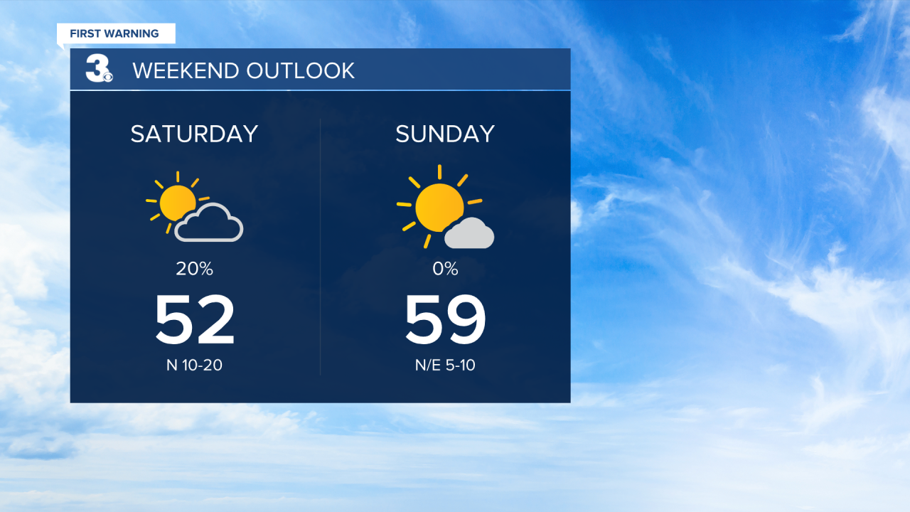
Overall, the weekend will be cooler but nice. Clouds should clear out early Saturday and we will see sunshine for the rest of the weekend. Highs will warm from the low 50s Saturday to the upper 50s Sunday.
Today: Sun & Clouds. Highs in the upper 70s. Winds: SW 10-15
Tonight: Partly Cloudy. Lows in the low 60s. Winds: SW 5-15
Tomorrow: Partly Cloudy. Highs in the upper 70s. Winds: SW/N 10-15
Weather & Health
Pollen: High (Juniper, Birch, Sycamore)
UV Index: 7 (High)
Air Quality: Good (Code Green)
Mosquitoes: Low
Weather updates on social media:
Facebook: MylesHendersonWTKR
Instagram: @MylesHendersonWTKR
