


Meteorologist Myles Henderson’s First Warning Forecast
A warm midweek with highs in the 80s. Tracking rain and a threat for severe storms for Thursday. A cooler Easter Sunday with highs in the 60s.
We will warm to the mid 80s this afternoon, about 15 degrees above normal for this time of year. Expect a nice mix of sun and clouds today with a SW wind at 5 to 15 mph.
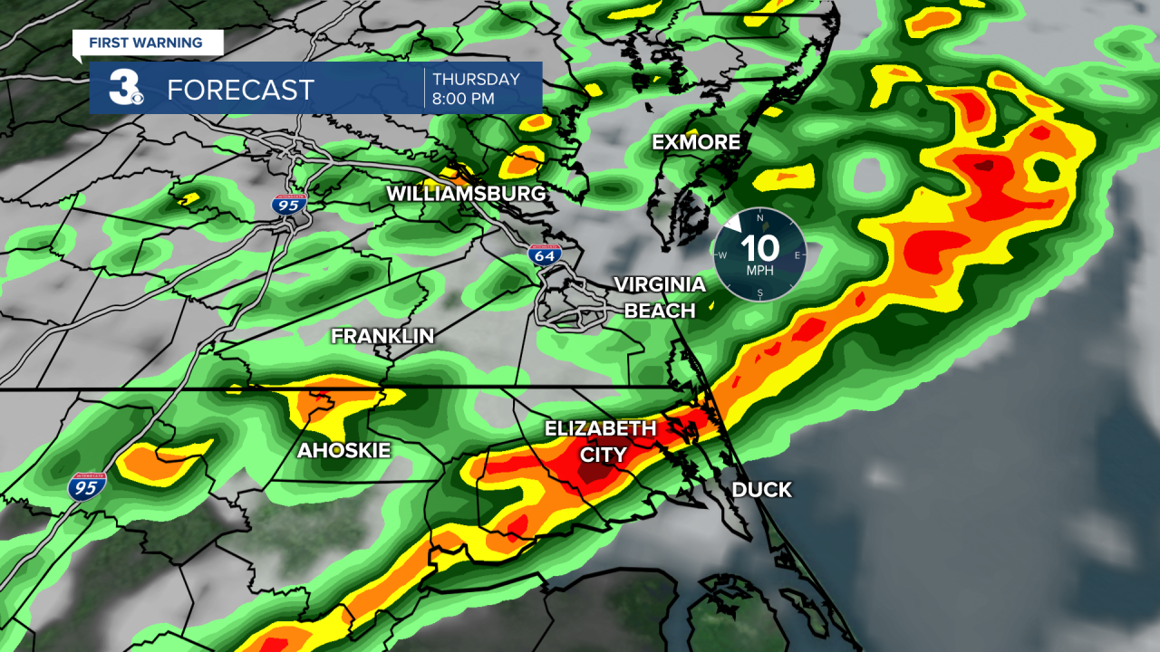
Our next rain chance will move in with a cold front on Thursday. Expect mostly cloudy skies with a few spotty showers during the day. Highs will reach the low 80s. Rain and storms chances will increase Thursday afternoon to evening (after 4 PM). Strong to severe storms are possible with damaging wind gusts, hail, and localized flooding. It will be windy Thursday with SW wind at 10 to 20 and gusts to 30+ mph.
We will see clearing skies on Friday and the wind will relax. Highs will drop to the upper 60s, near normal for this time of year.
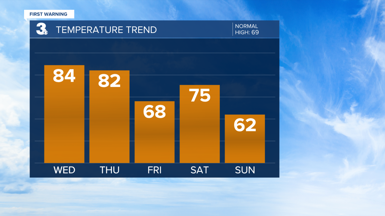
Expect a mix of sun and clouds this weekend with more clouds on Saturday and more sun on Sunday. A spotty shower is possible but overall rain chances will be limited. Highs will reach the mid 70s on Saturday then drop to the low 60s for Easter Sunday.
Today: Partly Cloudy. Highs in the mid 80s. Winds: SW 5-15
Tonight: Partly Cloudy. Lows in the mid 60s. Winds: SW 5-15
Tomorrow: Mostly Cloudy, PM Storms, Windy. Highs in the low 80s. Winds: SW 10-20
Weather & Health
Pollen: High (Oak, Maple, Elm)
UV Index: 6 (High)
Air Quality: Moderate (Code Yellow)
Mosquitoes: Low
Weather updates on social media:
Facebook: MylesHendersonWTKR
Twitter: @MHendersonWTKR
Instagram: @MylesHendersonWTKR
