




Meteorologist Myles Henderson’s First Warning Forecast
Warmer today but still comfortable with lower humidity. Building clouds to end the week. Rain returns to end the weekend.
Another cool start this morning with temperatures in the 50s. Highs will warm to the low 80s today, about 10 degrees warmer than yesterday. We will still see sunshine, but clouds will start to build in.
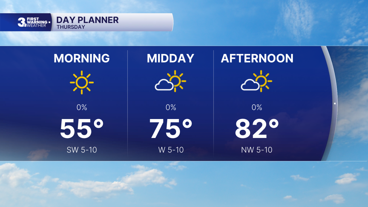
We will drop back to the mid 70s, near normal, for Friday with partly cloudy skies.
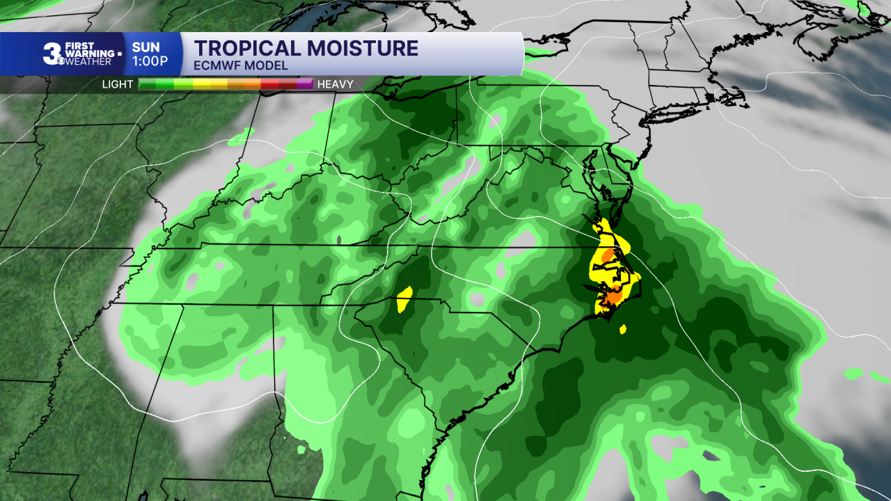
When it comes to our weekend forecast, all eyes are focused to the south. Hurricane Isaias is forecast to make landfall along U.S. Gulf Coast. That system will spread rainfall across the Southeast to Mid-Atlantic this weekend.
Expect mostly cloudy skies with slim rain chances and highs in the mid 70s Saturday. Widespread rain will move in Sunday with a stray storm possible. Wind will pick up, SE at 10 to 20 with gusts to 30 mph. Highs will return to the mid 70s.
Today: A Few Clouds. Highs in the low 80s. Winds: W 5-10
Tonight: Partly Cloudy. Lows in the low 60s. Winds: N 5-10
Tomorrow: Partly Cloudy. Highs in the mid 70s. Winds: N 5-10
Weather & Health
Pollen: Low (Ragweed)
UV Index: 5 (Medium)
Air Quality: Good (Code Green)
Mosquitoes: High
Tropical Update
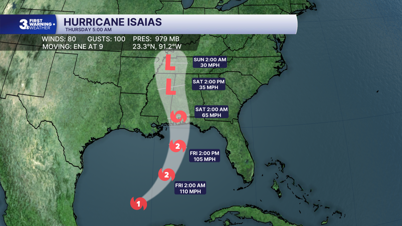
Hurricane Isaias continues to intensify over the Gulf. On the forecast track, Isaias is expected to pass to the north of the Yucatan Peninsula later today and make landfall along the U.S. northern Gulf Coast within the warning area late Friday or early Saturday.
Maximum sustained winds have increased near 80 mph with higher gusts. Additional strengthening is expected through early Friday, and Isaias should remain a strong hurricane as it approaches the northern Gulf Coast on Friday night.
Weather updates on social media:
Facebook: MylesHendersonWTKR
Instagram: @MylesHendersonWTKR
