


Meteorologist Myles Henderson’s First Warning Forecast
Our warm stretch of days continues. Highs in the 70s today, climbing to the 80s Sunday. Tracking rain with a cold front on Tuesday.
Get ready for a nice weekend! We will see a mix of mostly sunny to partly cloudy skies today with highs in the mid 70s, near normal for this time of year. We will warm to the mid 80s on Sunday with mostly sunny skies. Rain chances remain low through the weekend.
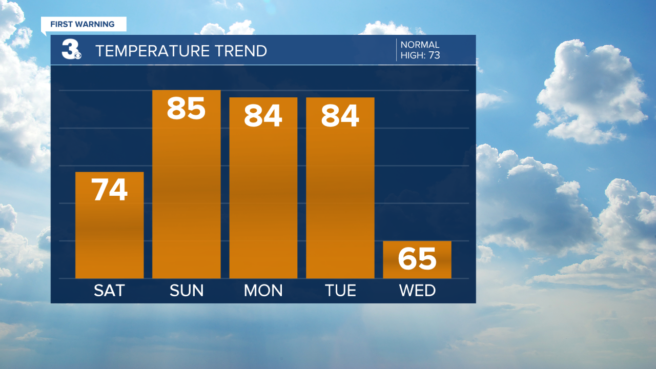
The warm weather will stick around for the start of the work week. Highs will return to the mid 80s on Monday with partly cloudy skies.
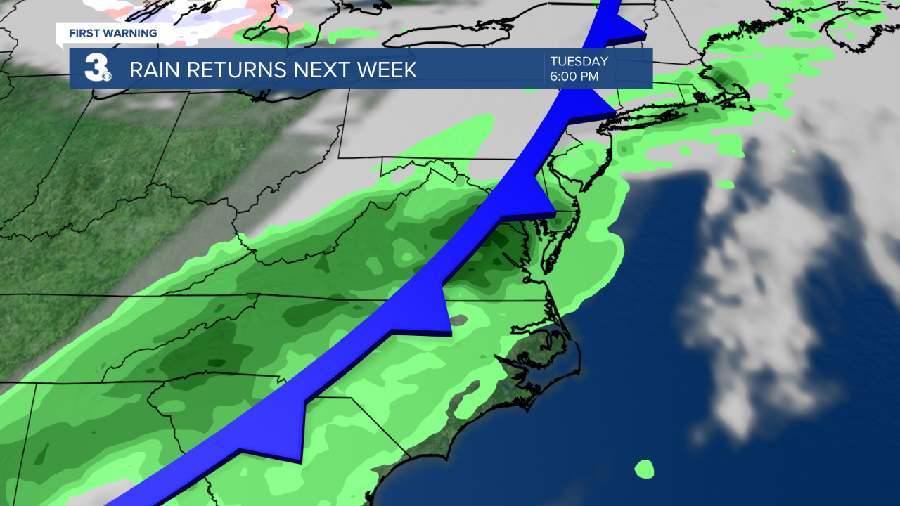
Our next chance for rain is set to move in with a cold front on Tuesday. As of now, the best chance for rain and storms will be in the late afternoon to late night (3 PM to 11 PM). Highs will drop from the mid 80s on Tuesday to the mid 60s on Wednesday, behind the cold front. Expect sunshine and 60s for the end of the work week.
Today: A Few Clouds. Highs in the mid 70s. Winds: E/SE 5-15
Tonight: A Few Clouds. Lows in the upper 50s. Winds: S 5-10
Tomorrow: Mostly Sunny. Highs in the mid 80s. Winds: SW 5-15
Weather & Health
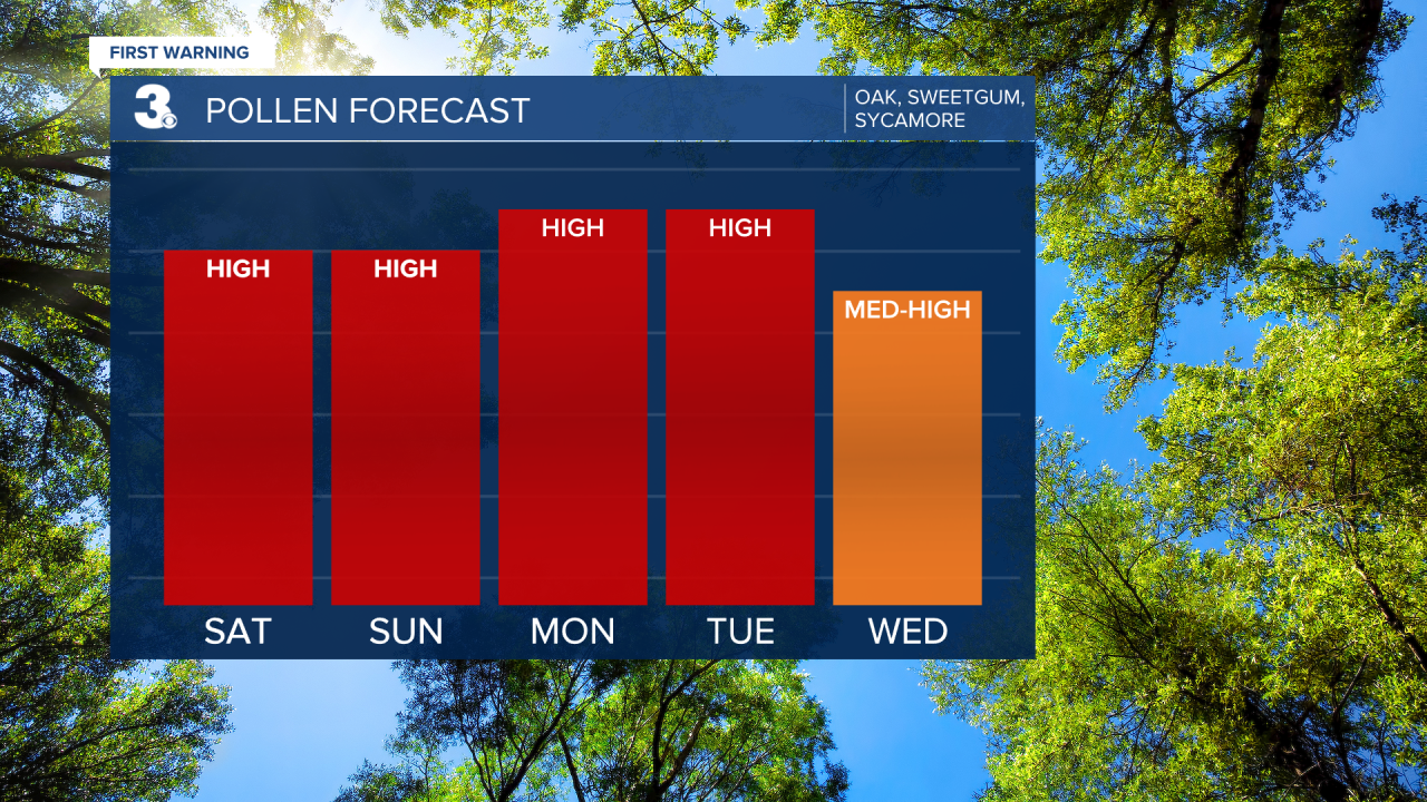
Pollen: High (Oak, Sweetgum, Sycamore)
UV Index: 9 (Very High)
Air Quality: Good (Code Green)
Mosquitoes: Low-Moderate
Weather updates on social media:
Facebook: MylesHendersonWTKR
Twitter: @MHendersonWTKR
Instagram: @MylesHendersonWTKR
