


Meteorologist Myles Henderson’s First Warning Forecast
Warming up and building humidity to end the week. Tracking showers for the weekend.
Even warmer today with highs near 90, above normal for this time of year. It will feel more like the mid 90s with the increasing humidity. Expect mostly sunny skies today with a bit of a southerly breeze.

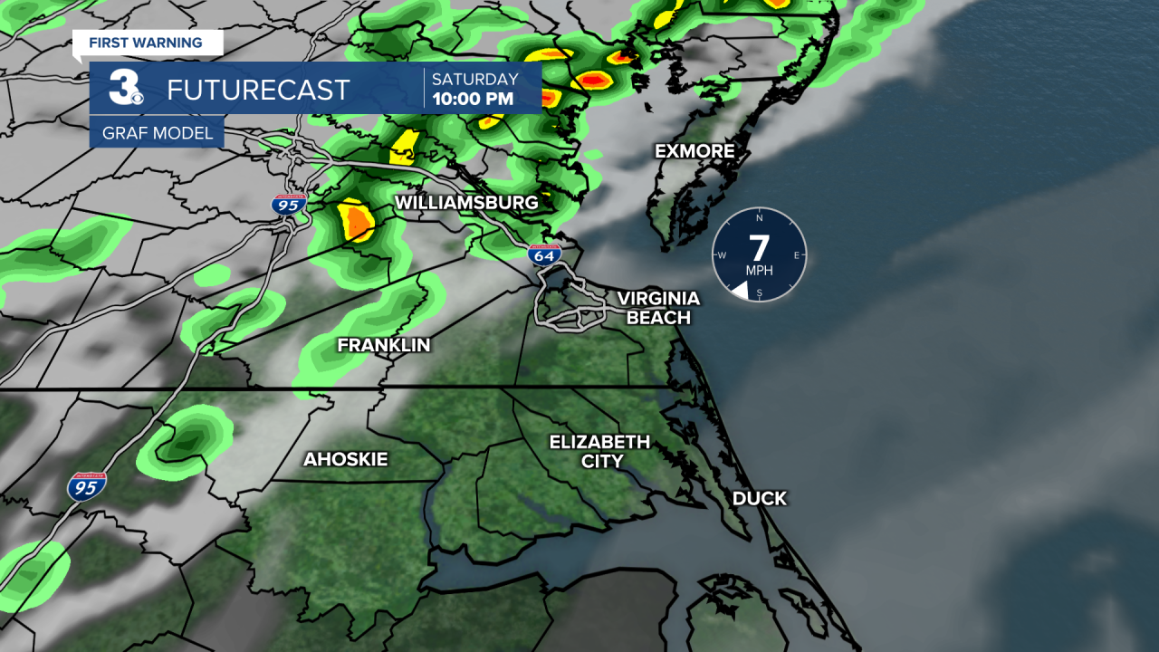
Warm again on Saturday with highs near 90 and an afternoon heat index near 95. We will see a nice mix of sun and clouds during the day. Showers will build in Saturday night with a cold front. An isolated storm is possible.
Temperatures will drop by about 15 degrees on Sunday, behind the cold front. Expect highs in the mid 70s with falling humidity. We will see a mix of partly to mostly cloudy skies with scattered showers lingering.
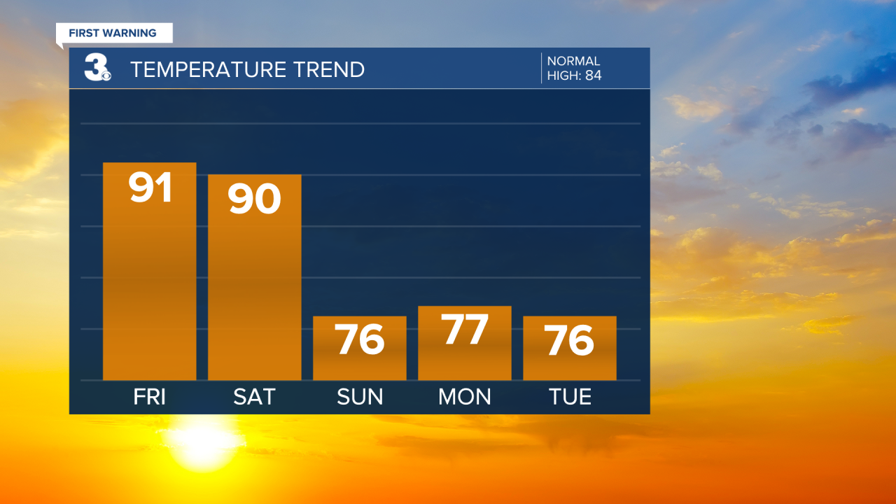
It will feel more like fall next week with highs in the mid to upper 70s and lower humidity. Rain chances will return for midweek as a stationary front sets up along the coast.
Today: Mostly Sunny. Highs near 90. Winds: S 5-15
Tonight: Mainly Clear. Lows near 70. Winds: S 5-10
Tomorrow: Partly Cloudy. Highs near 90. Winds: S 5-15
Weather & Health
Pollen: Medium-High (Ragweed)
UV Index: 8 (High)
Air Quality: Good (Code Green)
Mosquitoes: Very High
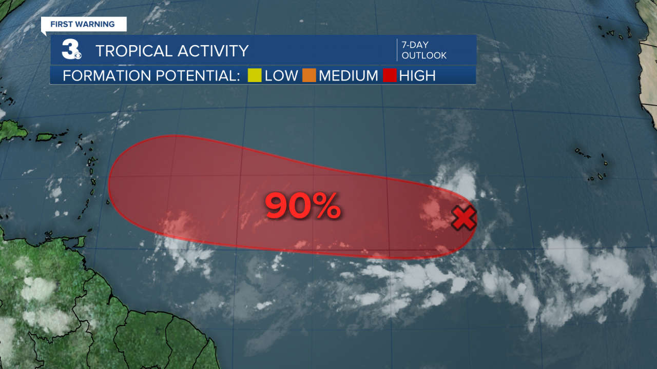
Tropical Update
Tracking a broad area of low pressure over the eastern tropical Atlantic, associated with a tropical wave. Environmental conditions are favorable for development of this system, and a tropical depression is likely to form by this weekend as it moves slowly west across the central tropical Atlantic. This system is likely to be near the Lesser Antilles by the middle to latter part of next week.
* Formation chance through 48 hours: Medium (60%)
* Formation chance through 7 days: High (90%)
Weather updates on social media:
Facebook: MylesHendersonWTKR
Instagram: @MylesHendersonWTKR
