

First Warning Forecast:
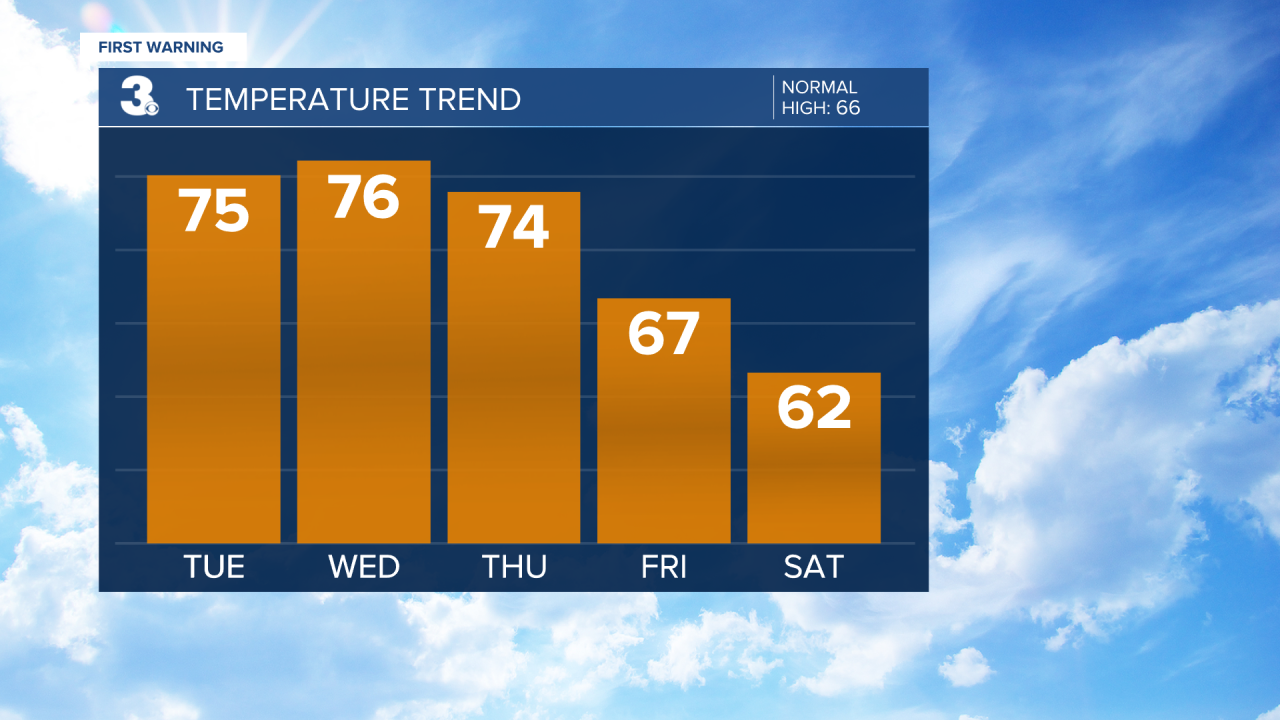
Temperatures trend above normal this week, but the warmer weather will also bring the chance for spring showers and storms.
WTKR Weather
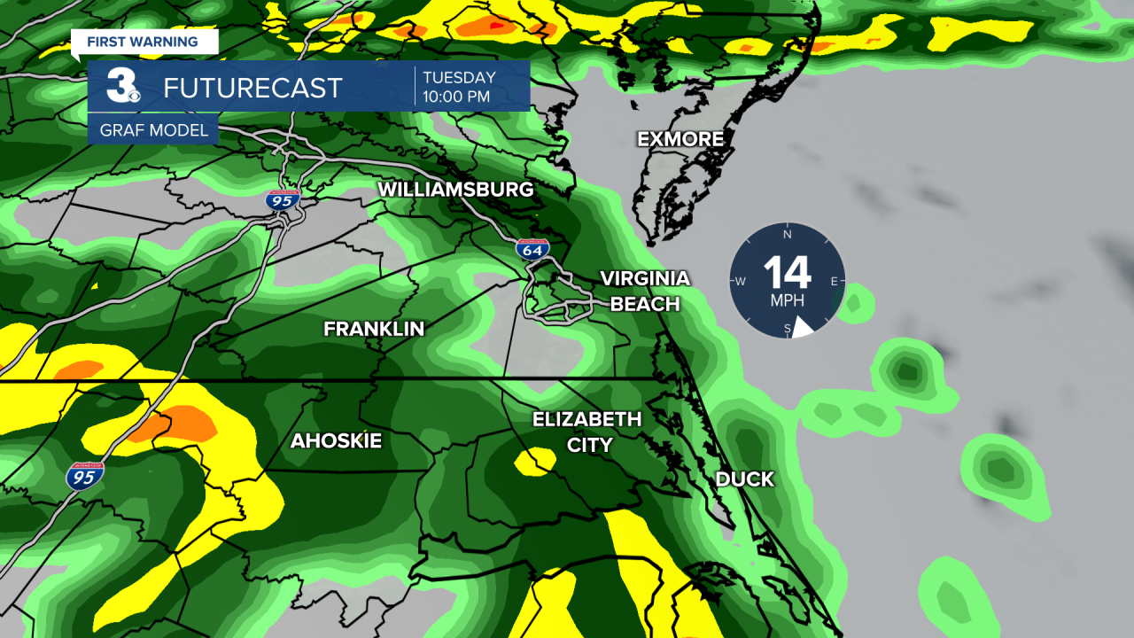
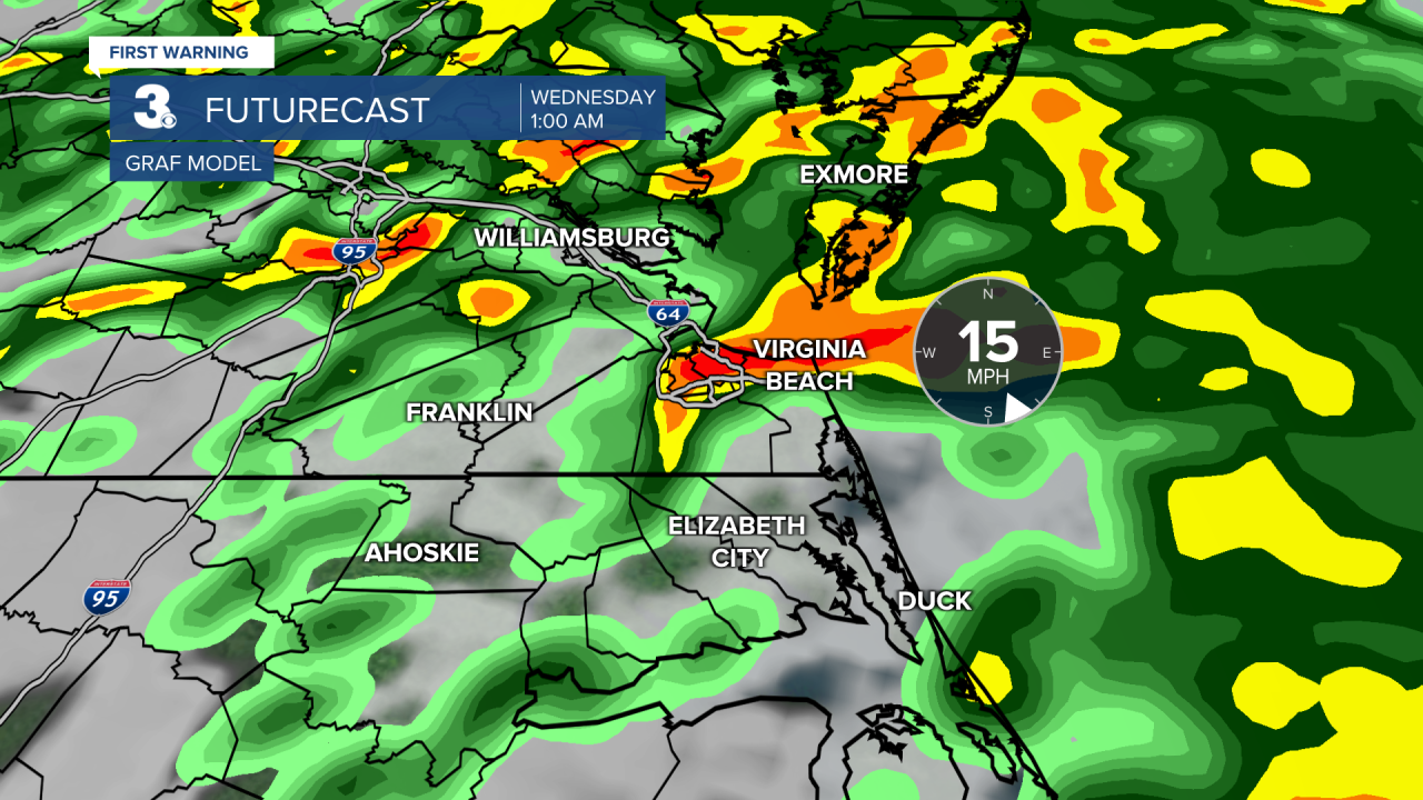
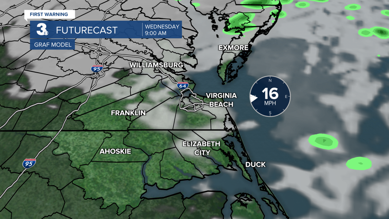
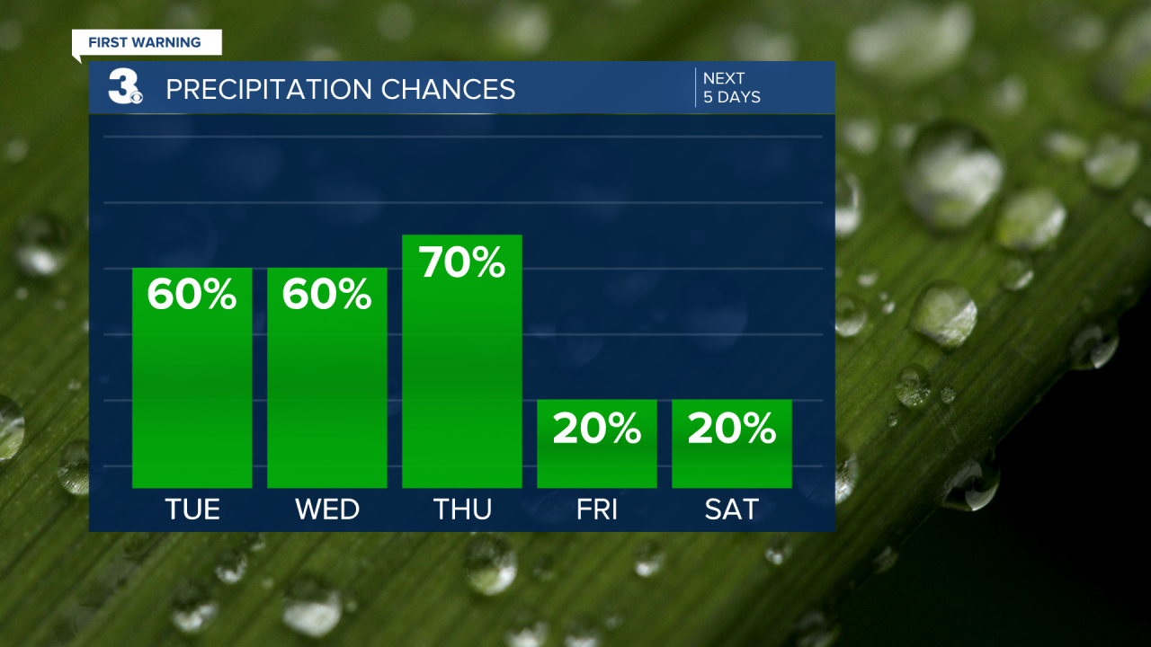
An area of low pressure will approach on Tuesday. Most of the daylight hours are looking dry with rain moving in late. Temperatures will warm to the mid 70s. Showers will become widespread overnight before tapering off into Wednesday morning.
WTKR Weather
WTKR Weather
WTKR Weather
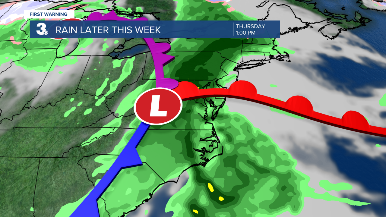
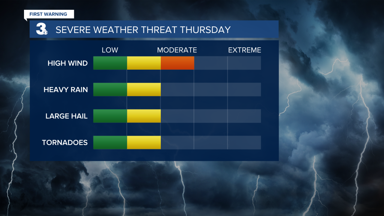
A cold front will cross the area on Thursday. This will bring showers and storms to the area. We will keep our eye out for any strong to severe storms. Temperatures will once again be mild with highs in the low 70s.
WTKR News 3
WTKR Weather
Cooler behind the cold front on Friday. A few spotty showers will be possible with highs in the mid 60s.
WTKR Weather
