


Meteorologist Myles Henderson’s First Warning Forecast
Warming to the 50s and 60s to end the week. Rain returns late Thursday to early Friday.
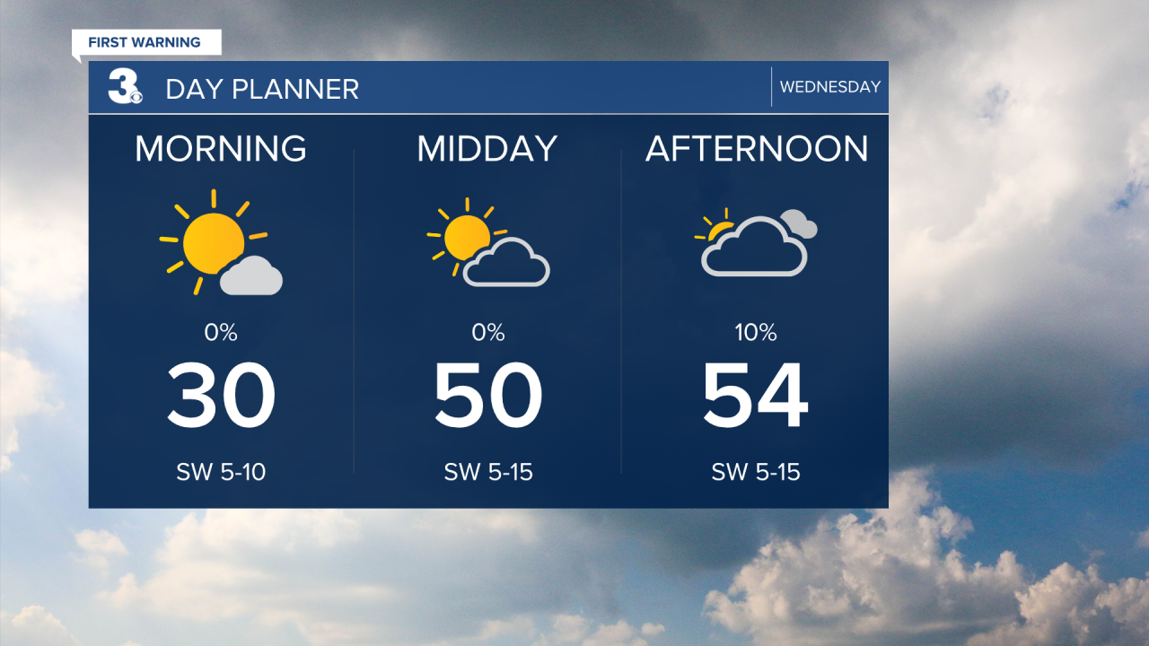
We will warm to the mid 50s today near normal for this time of year. We will see sunshine early this morning, but clouds will build in throughout the day.
Highs will climb to near 60 on Thursday. Expect partly to mostly cloudy skies with an isolated shower possible during the day.
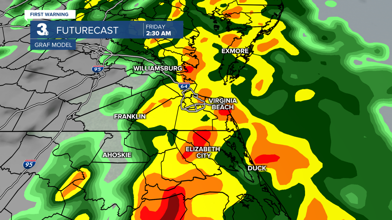
Rain chances will increase Thursday night to Friday morning as a cold front moves through. Showers should clear out Friday morning with clearing skies in the afternoon. Temperatures will fall from the upper 50s to the upper 40s and it will be windy.
Today: Building Clouds. Highs in the mid 50s. Winds: SW 5-15
Tonight: Mostly Cloudy. Lows upper 30s. Winds: SW 5-10
Tomorrow: Mix of Clouds, Rain Late. Highs near 60. Winds: S 5-15
Weather updates on social media:
Facebook: MylesHendersonWTKR
Instagram: @MylesHendersonWTKR
