


Meteorologist Myles Henderson’s First Warning Forecast
A warming trend to end the work week. Tracking rain for Friday with a cold front. Much cooler and mostly sunny this weekend.
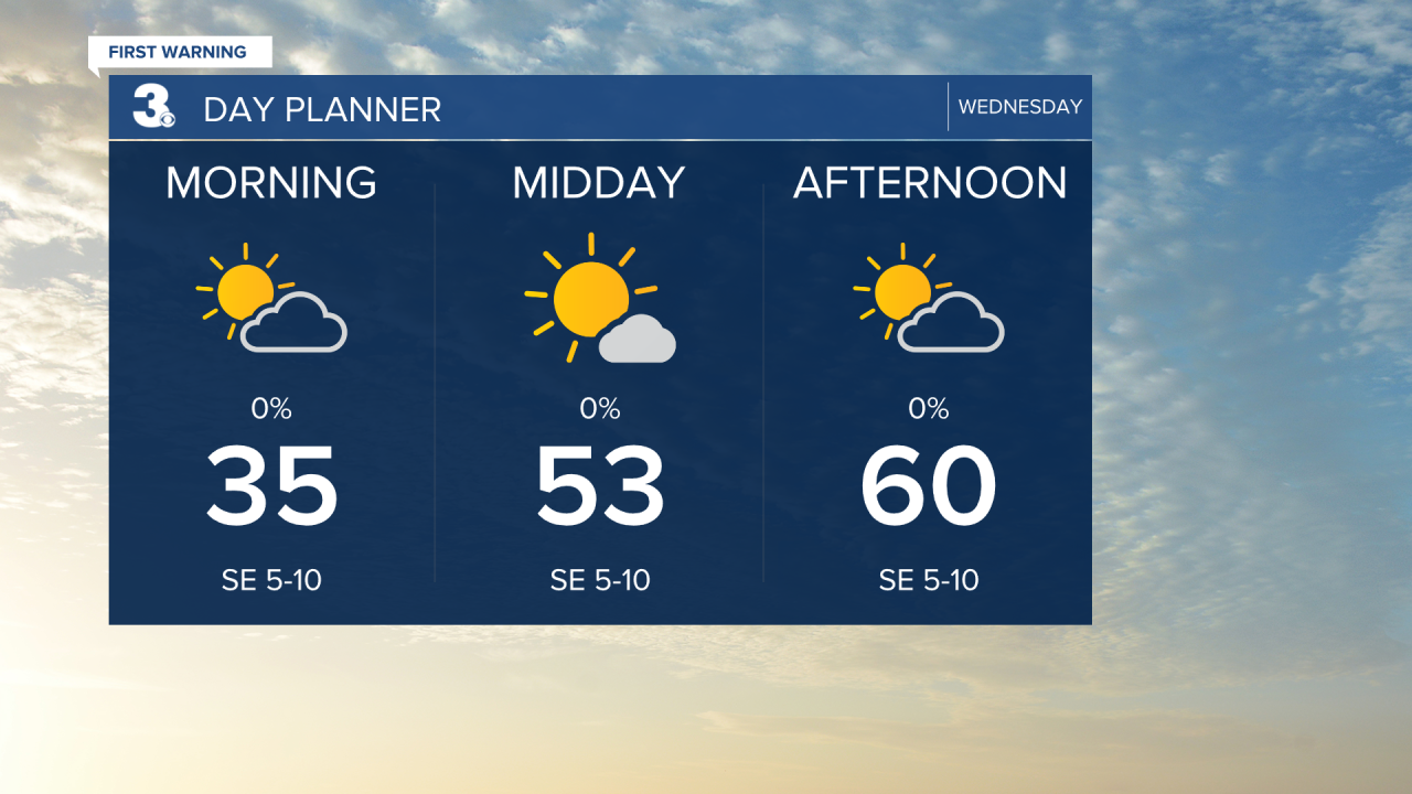
Another cold start with temperatures in the 30s this morning. We will warm to near 60 this afternoon, closer to normal for this time of year. Look for a mix of mostly sunny to partly cloudy skies.
We will continue to warm up for the end of the work week. Highs will climb to the mid and upper 70s on Thursday and closer to 80 on Friday.
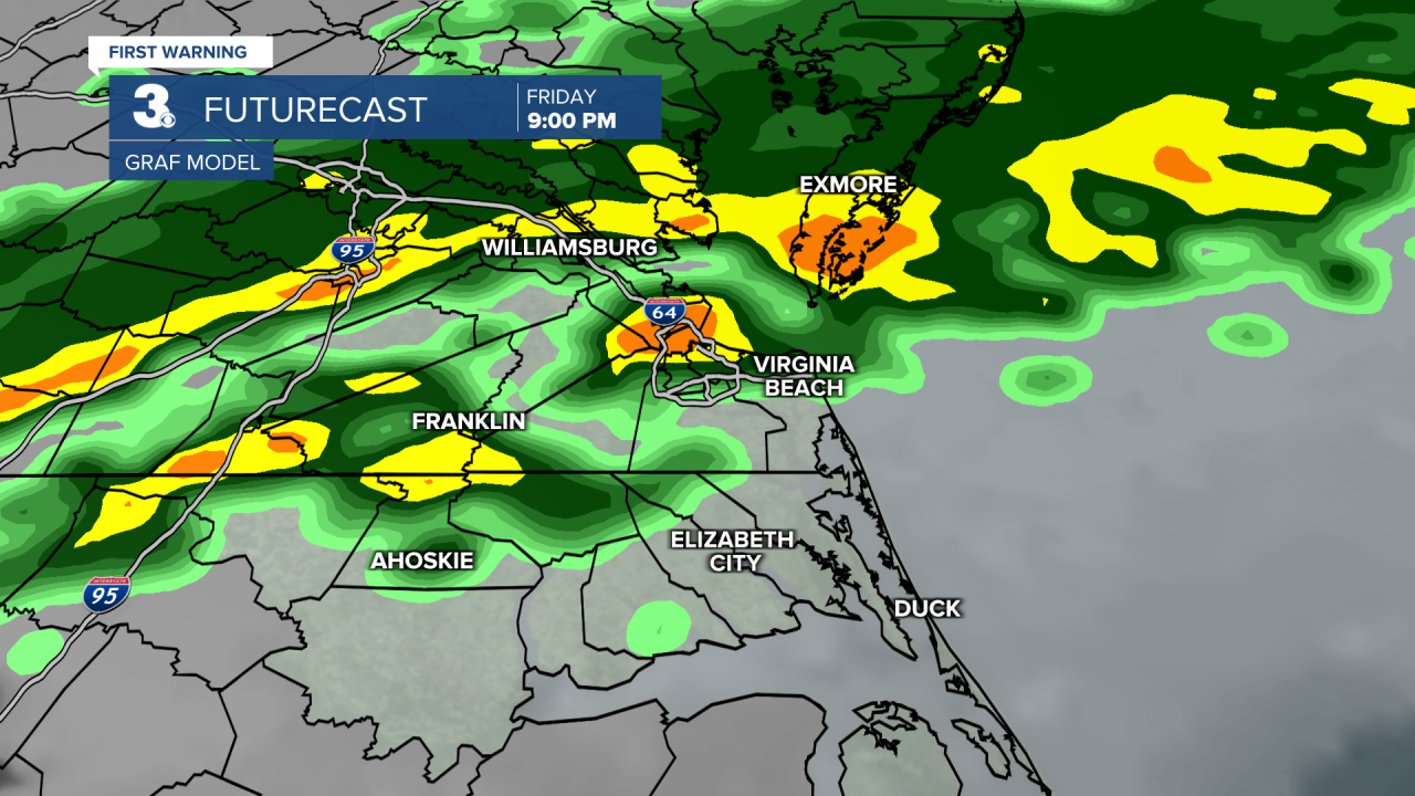
A cold front is set to move in on Friday bringing us rain and a cold down. Watch out for showers Friday night to early Saturday morning. We will see another cool down from near 80 on Friday to near 50 on Saturday.
Overall, the weekend will be cooler but nice. Clouds should clear out early Saturday and we will see sunshine for the rest of the weekend. Highs will warm from the low 50s Saturday to the upper 50s Sunday.
Today: Sun & Clouds. Highs near 60. Winds: SE 5-10
Tonight: Partly Cloudy. Lows near 50. Winds: S 5-10
Tomorrow: Sun & Clouds. Highs in the upper 70s. Winds: SW 5-15
Weather & Health
Pollen: High (Juniper, Birch, Sycamore)
UV Index: 6 (Moderate-High)
Air Quality: Good (Code Green)
Mosquitoes: Low
Weather updates on social media:
Facebook: MylesHendersonWTKR
Instagram: @MylesHendersonWTKR
