


Meteorologist Myles Henderson’s First Warning Forecast
A coastal low lingers along the Mid-Atlantic coast, bringing us rain, wind, and tidal flooding.
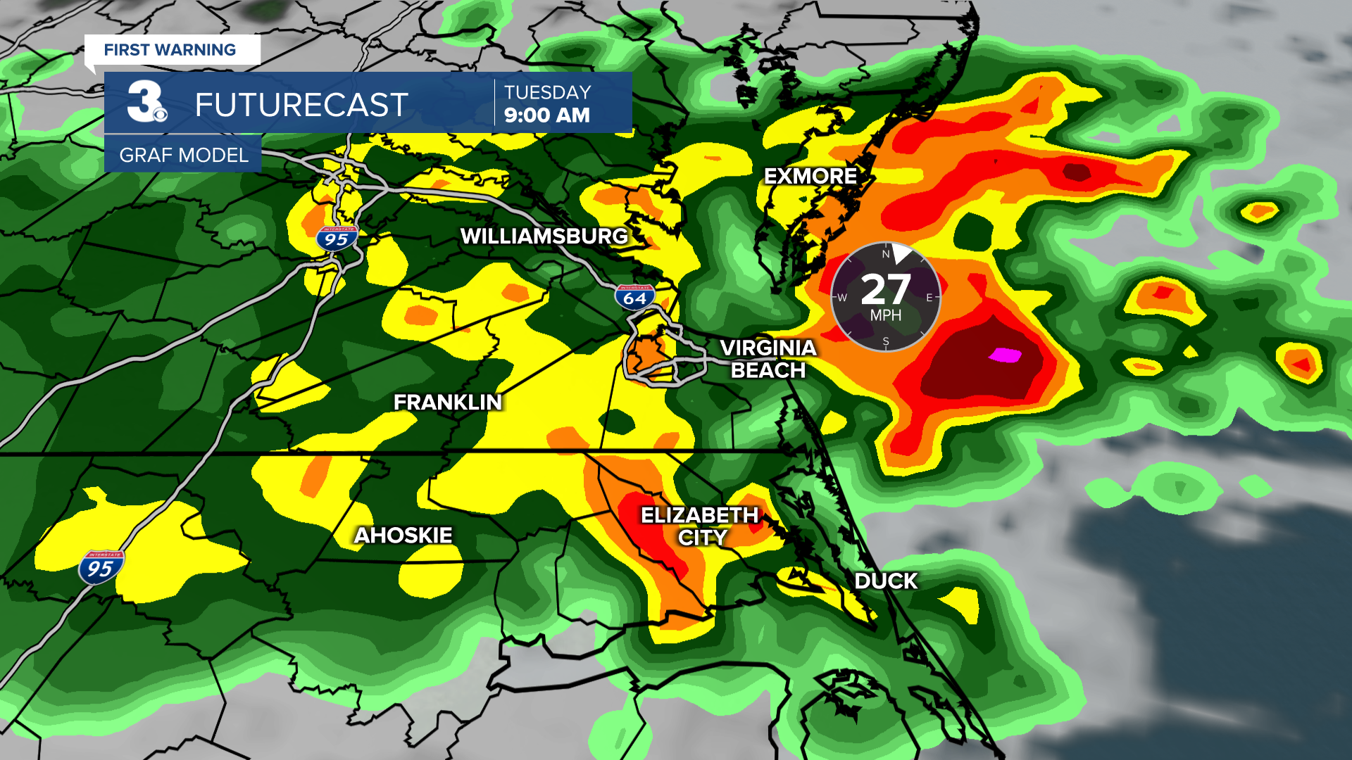
Expect widespread rain today, especially in the morning. Heavy downpours and isolated storms are possible, bringing localized flooding and even a stray tornado. Winds will continue to gust to 30+ mph. The persistent NE wind will trigger flooding near times of high tide. The biggest tidal flooding threat will be near high tide this evening (6 pm).

Winds will back down on Wednesday, and the showers will become more scattered. Highs will return to the mid 70s.
Look for more sunshine and a warming trend to end the work week. Clouds will break up and clear out on Thursday with highs in the upper 70s. Highs will reach the low to mid 80s on Friday with mostly sunny skies.

Today: Rain, Windy. Highs in the low 70s. Winds: NE 20-30G45
Tonight: Showers, Windy. Lows in the mid 60s. Winds: NE 10-20
Tomorrow: Scattered Showers. Highs in the mid 70s. Winds: NE 5-15
Weather & Health
Pollen: Low (Ragweed)
UV Index: 1 (Low)
Air Quality: Good (Code Green)
Mosquitoes: Very High
Tropical Update
Tracking a broad area of low pressure located about midway between the Windward Islands and the coast of west Africa. Environmental conditions are conducive for further development, and a tropical depression or storm is likely to form in the next day or two as the system moves WNW to NW over the central tropical Atlantic.
* Formation chance through 48 hours: High (80%)
* Formation chance through 7 days: High (90%)
Watching a tropical wave emerging off the west coast of Africa. Some slow development of this system is possible towards the mid to latter part of this week as it moves from the eastern to central portion of the tropical Atlantic.
* Formation chance through 48 hours: Low (0%)
* Formation chance through 7 days: Low (20%)

Weather updates on social media:
Facebook: MylesHendersonWTKR
Instagram: @MylesHendersonWTKR
