


First Warning Forecast:
We're getting a chance to clear out and dry out this Friday night. Clouds will continue to thin overnight as lows drop to the upper 40s.
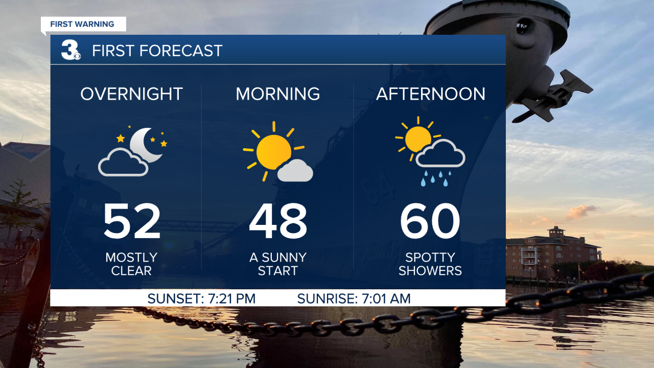
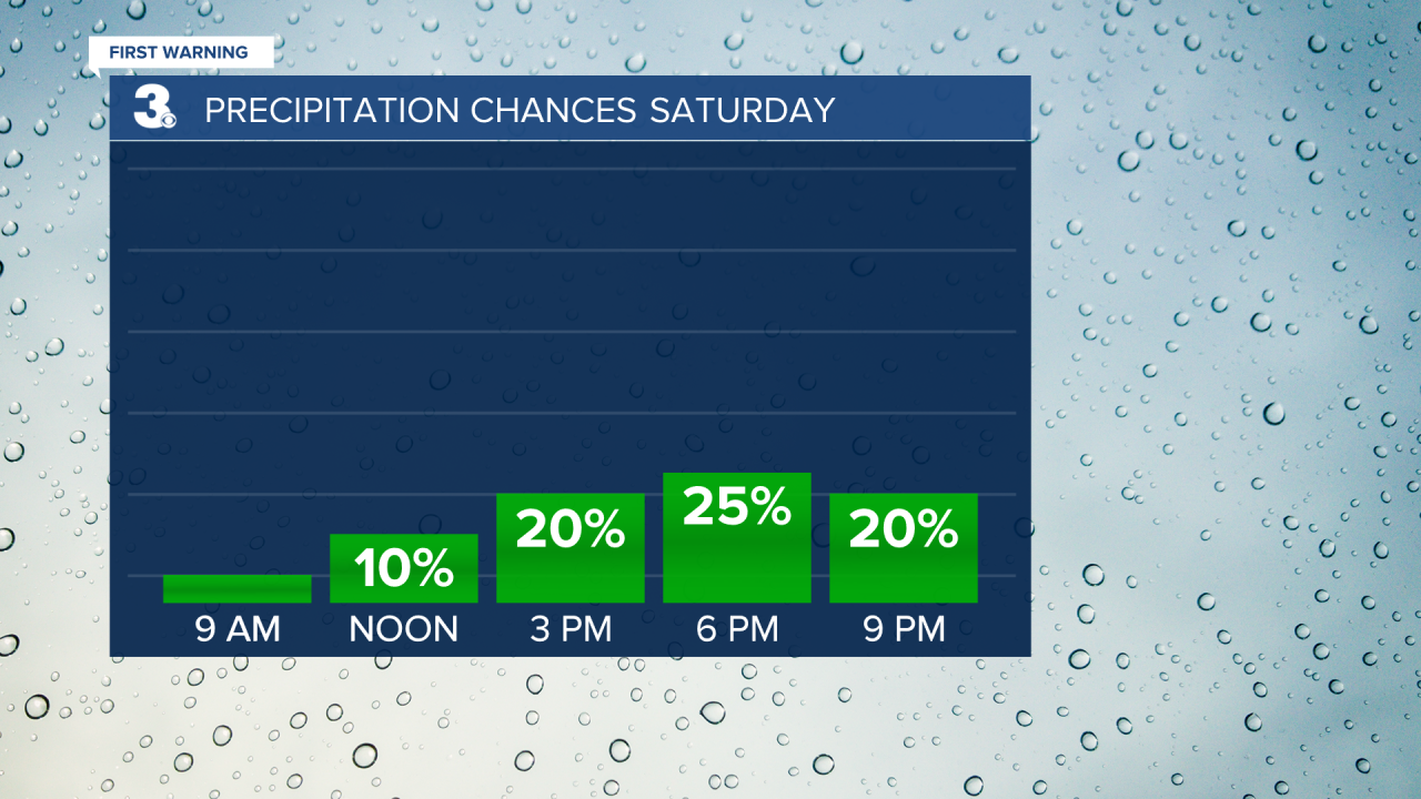
Expect sunshine Saturday morning with more clouds and scattered showers by the afternoon to evening as our next cold front moves through. Despite the passage of this cold front, rain chances will only be at or below 25%, which is good if you've got plans to be out and about, we should stay dry. But get ready for it to be windy. Winds will kick up starting tomorrow, west at 10 to 20 with gusts to 30 mph. And it'll also be cooler. Highs will only reach the low 60s on Saturday.
Highs will only reach the mid 50s on Sunday. We will see a nice mix of sun and clouds, but it will still be windy with NW winds at 10 to 20 and gusts to 30 mph.
Sunday night and Monday morning gets cold! Lows drop to the low to mid 30s, feeling like the mid 20s. Highs in the low 50s, but lots of sunshine to kick off the workweek.
Temperatures jump back up to the mid 60s Wednesday and into the 70s the second half of the workweek. The trade-off for warmer temperatures will be isolated to widely scattered rain showers.
