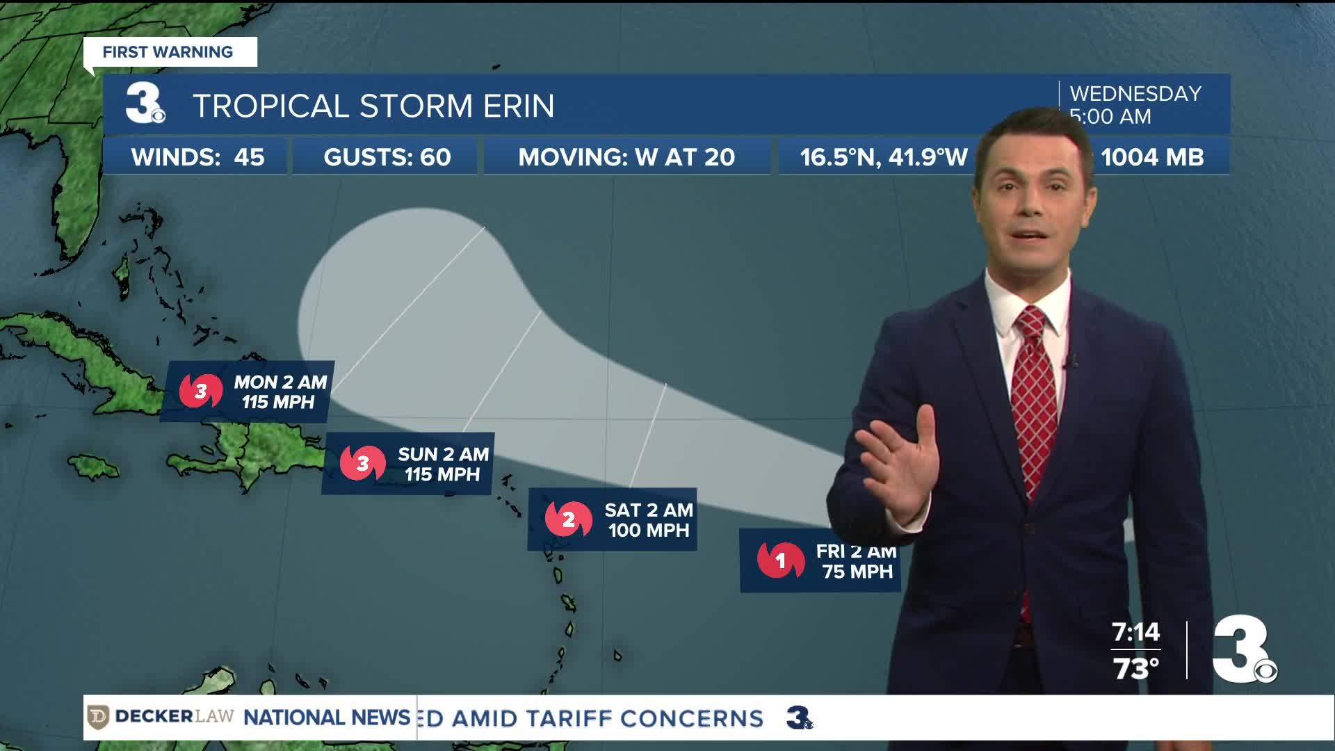


Tropical Storm Erin continues moving over the open Atlantic. Erin is centered about 1,400 miles east of the northern Leeward Islands and moving west at 20 mph.
This general motion is expected into Thursday, with a WNW motion beginning Thursday night and continuing into the weekend. On the forecast track, the center of Erin is likely to move near or just north of the northern Leeward Islands over the weekend.
Maximum sustained winds remain near 45 mph with higher gusts. Gradual strengthening is forecast to begin today, and Erin will likely become a hurricane by late Thursday or early Friday.
Related coverage: Monitoring Erin, the first hurricane threat of the season on the horizon
Weather updates on social media:
Facebook: MylesHendersonWTKR
Instagram: @MylesHendersonWTKR
