


Meteorologist April Loveland's First Warning Forecast
Partly cloudy, but warmer to kick off the work week. Temperatures will soar all the way to the low and mid 60s! A spotty shower is not out of the question a little later in the day, but most areas will remain dry.
Even warmer on Tuesday. More clouds will build in, but temperatures will warm to near 70. Showers will be possible overnight and into Wednesday morning. Temperatures will warm to the low 70s once again. The wind will stick around.
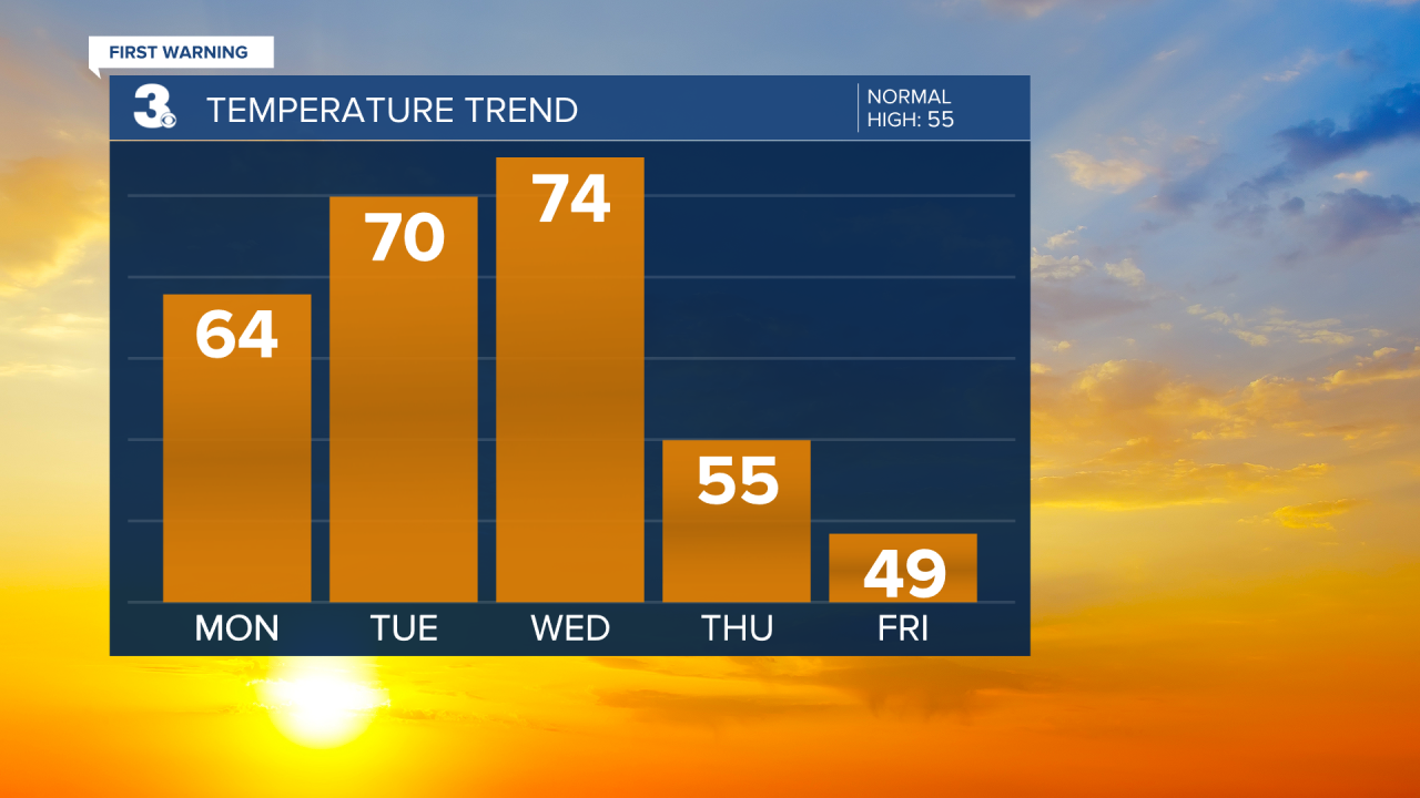
Breezy and cooler on Thursday. Showers will be possible during the morning hours with highs in the mid 50s. Winds will be out of the northwest at 10-20 mph. A few higher gusts will be possible.

Even cooler to kick of the month of March and the first day of Meteorological Spring. Temperatures will top out in the upper 40s to near 50. Skies will be partly cloudy.
A nice warm up on Saturday. Expect highs around 60 degrees with a chance of scattered showers.

Meteorologist April Loveland
For weather updates on Facebook: HERE
Follow me on Twitter: HERE
Follow me on Instagram HERE
Check out the Interactive Radar on WTKR.com: Interactive Radar
