


Meteorologist April Loveland's First Warning Forecast
It will be milder on Wednesday with highs in the mid and upper 60s. Skies will be mostly sunny.

There will be an increased fire danger on Wednesday due to dry vegetation, low relative humidity and gusty winds.

A Red Flag Warning is in effect for a portion of the area.

Another cool down heading into Thursday. Expect highs in the low 50s. It will still be sunny.
An area of low pressure will approach on Friday. Showers are expected to develop during the evening hours. Highs will warm to the upper 50s.
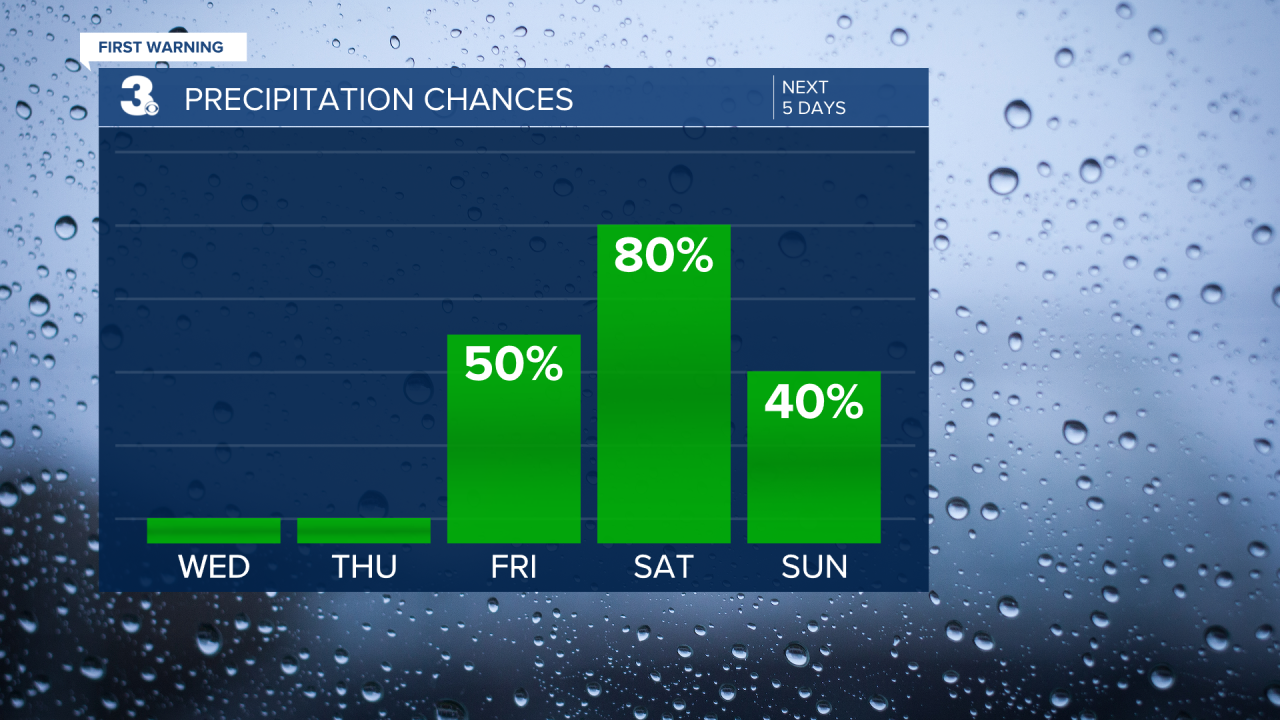
Saturday is looking wet and windy as a coastal low impacts the area. Highs will be in the low 60s. Winds will be out of the northeast at 15-25 mph with gusts up to 35 mph.

Keeping a chance for showers to linger into Sunday. We will continue to keep an eye on this. Expect highs in the mid 50s.
Meteorologist April Loveland
For weather updates on Facebook: HERE
Follow me on Twitter: HERE
Follow me on Instagram HERE
Check out the Interactive Radar on WTKR.com: Interactive Radar
