


Meteorologist April Loveland's First Warning Forecast

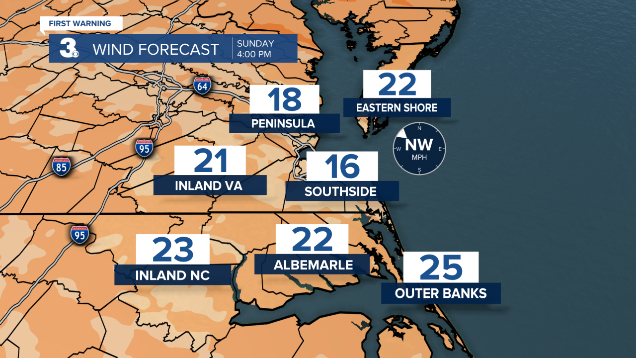
High pressure will build in today. This will bring a nice mix of sun and clouds. Temperatures will be in the 50s. It will be windy with winds out of the west and northwest at 15-25 mph. Gusts 30-40 mph will be possible. A Wind Advisory goes into effect this evening for the Eastern Shore and Outer Banks.
Sunny and windy to kick off the work week. Temperatures will trend in the upper 50s. It will be windy! Winds will be out of the northwest at 15-25 mph. Gusts 30-40 mph will be possible.
We'll finally say goodbye to the wind on Tuesday. It's looking like a really nice day with highs in the mid 60s. Skies will be sunny.

The warming trend continues on Wednesday. It will still be dry with highs in the upper 60s to near 70. Skies will be partly sunny.
Even warmer on Thursday. Highs will soar to the low 70s.
Scattered showers will be possible Friday afternoon. It will be warm with highs in the low and mid 70s.


Meteorologist April Loveland
For weather updates on Facebook: HERE
Follow me on Twitter: HERE
Follow me on Instagram HERE
Check out the Interactive Radar on WTKR.com: Interactive Radar
