


Meteorologist Kristy Steward's First Warning Forecast
Good Friday night! Ian’s remnants are continuing to impact us for the next few days, but we will soon catch a lull in the activity.
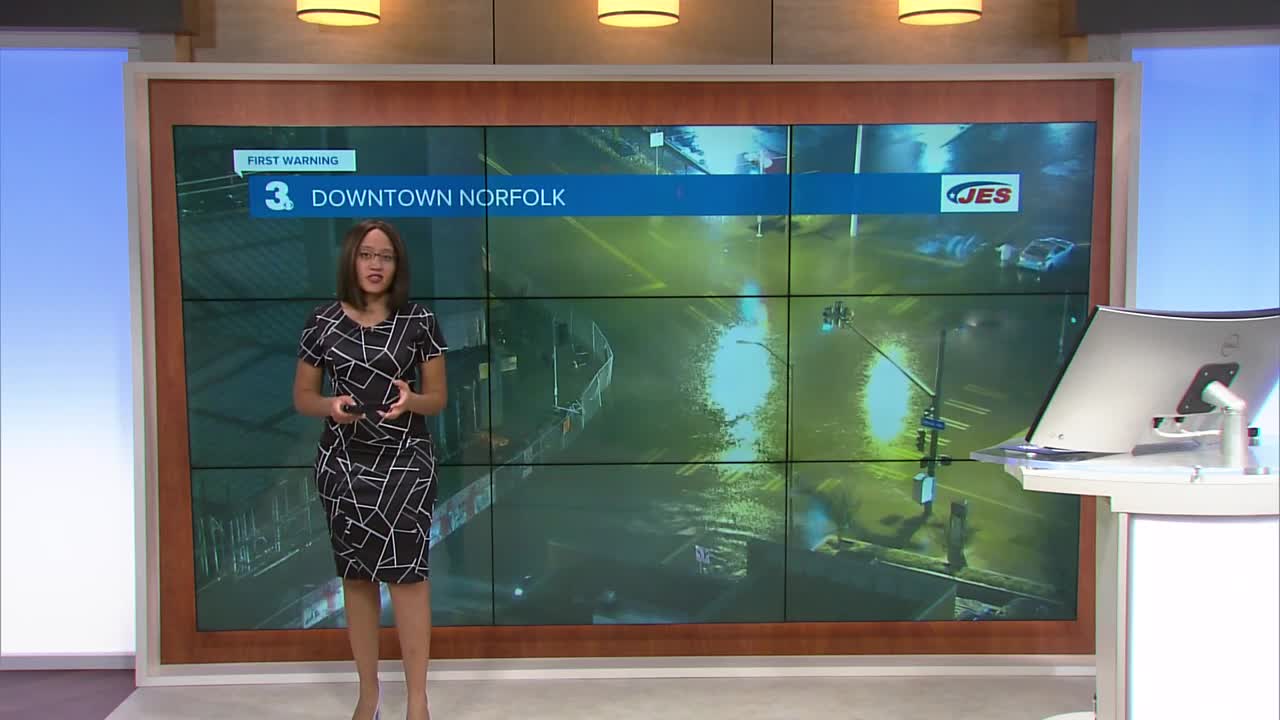
A dry slot is working its way into Hampton Roads. We’ll see the bulk of the rain ending around Midnight. There will still be some lingering light spotty rain showers into Saturday morning though.
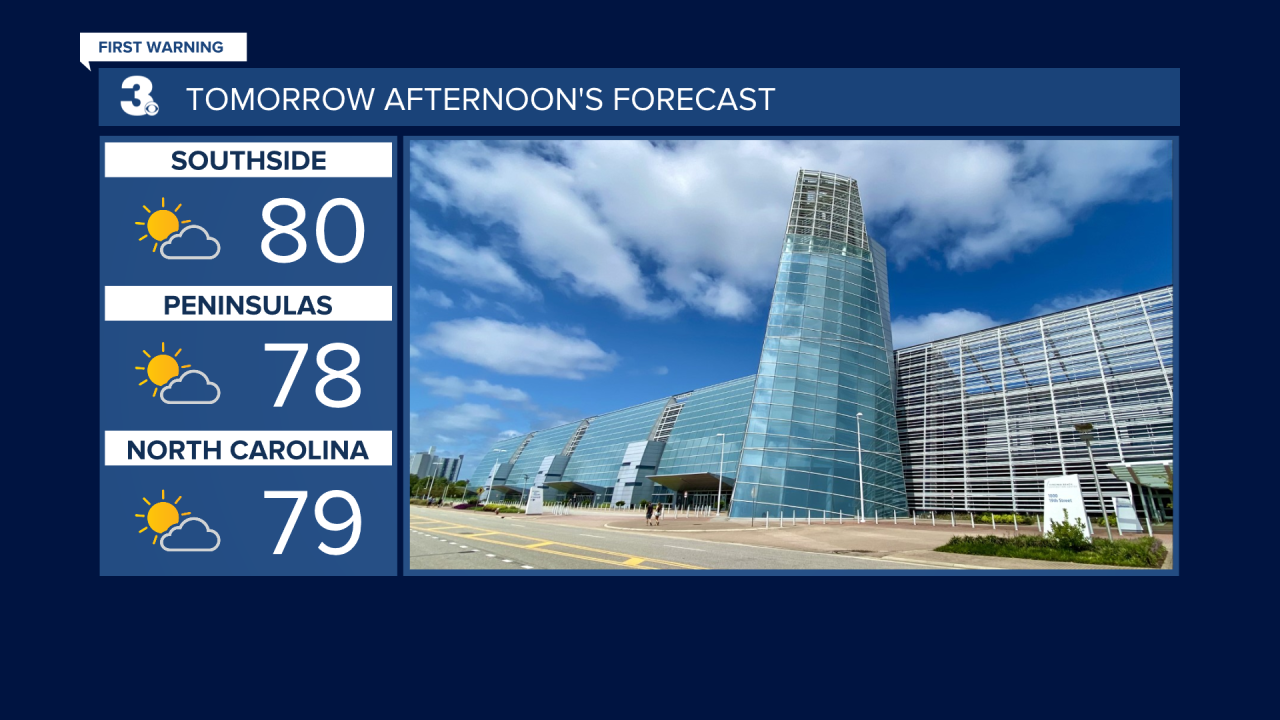
Most of Saturday will feature a nice lull in Ian’s remnant activity. Much of the day should be decently dry and it looks like we’ll even have some decent periods of sunshine! Winds die down and switch to a southerly flow. High temperatures soar to around 80°.
Don’t get too used to these nicer conditions just yet… Ian’s remnants head east and return to Hampton Roads Sunday into the start of the workweek.
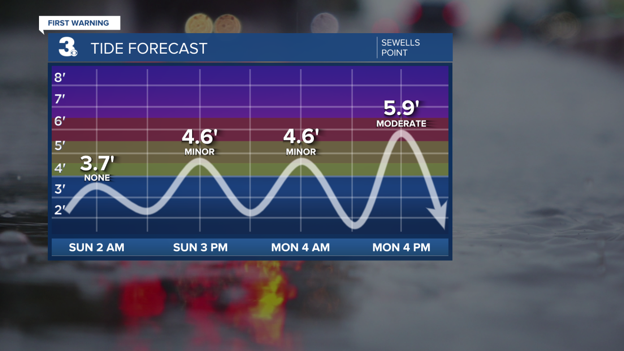
Expect scattered to widespread rain showers, stronger north-northeast winds, and more rounds of tidal flooding the second part of Sunday, throughout Monday, and into Tuesday morning. Once we dry out by the middle of the workweek, we’ll finally be done with Ian’s remnants. Lots of sunshine and dry weather will return the entire second half of the workweek.
Temperatures will be up and down. Highs go from 80 Saturday to the mid 60s Monday and Tuesday, back into the mid 70s Thursday.
Connect with Meteorologist Kristy Steward:
FACEBOOK
TWITTER
INSTAGRAM
