


Meteorologist April Loveland's First Warning Forecast
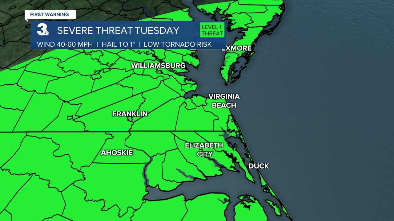
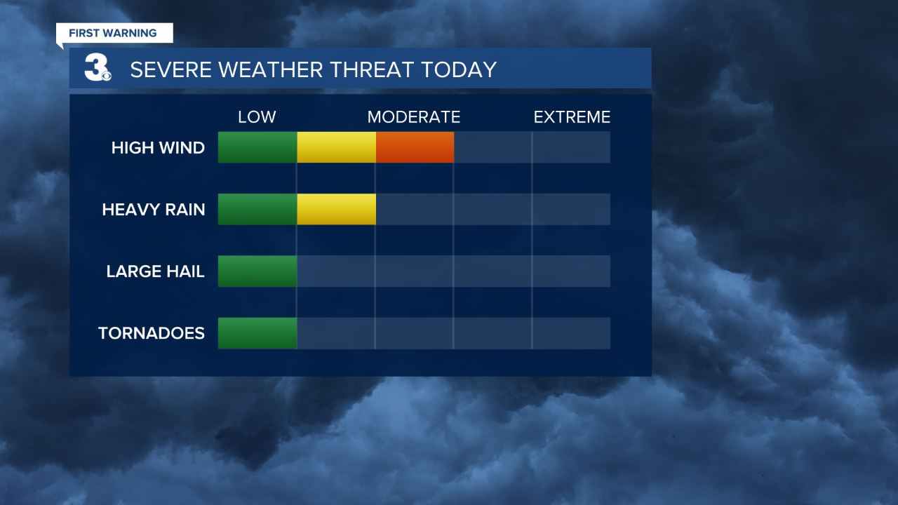
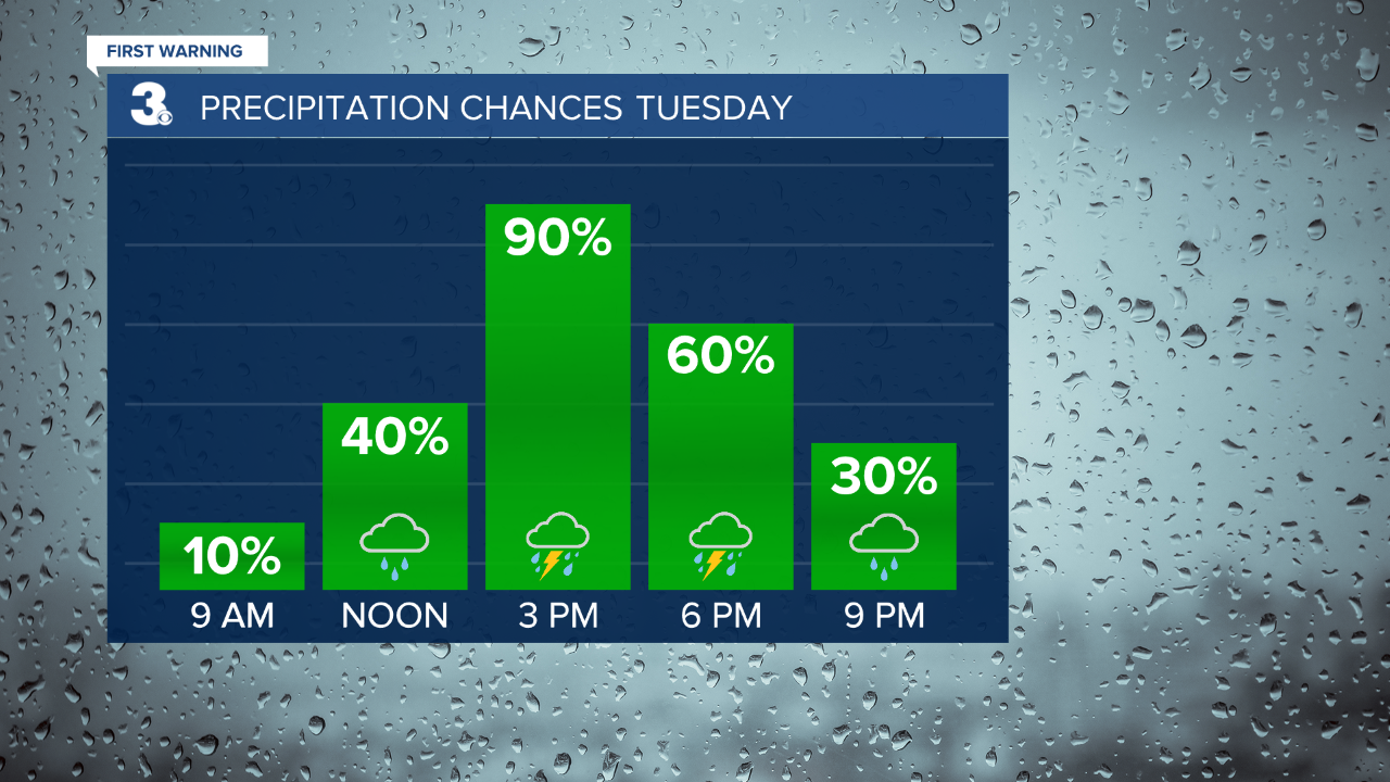
A strong cold front will cross the area today bringing the chance for strong to severe storms. The biggest threats will be damaging wind gusts and heavy rainfall. There is also a threat of flash flooding with these storms. Remember, if you come across a flooded roadway, turn around, don't drown. The front will push south of the area tonight with a few showers possible. Temperatures will dip into the mid 60s.
Milder and less humid on Wednesday as high pressure builds in. Temperatures will warm to the mid 70s with clearing skies as the day progresses.
Thursday will be another comfortable day for late June. Highs will warm to the upper 70s under partly cloudy skies.
A disturbance will be over the area of Friday which could spark scattered storms. It will be hanging out over the area into next week, which means afternoon showers and storms will be possible and heat and humidity build into the area once again. Expect highs in the low 80s on Friday, mid 80s on Saturday and upper 80s on Sunday and Monday.
Weather & Health
Pollen: Low-Medium (Grasses)
UV Index: 7 (High)
Air Quality: Good (Code Green)
Mosquitoes: Very High
Meteorologist April Loveland
For weather updates on Facebook: HERE
Follow me on Twitter: HERE
Follow me on Instagram HERE
Check out the Interactive Radar on WTKR.com: Interactive Radar
