


Meteorologist Myles Henderson’s First Warning Forecast
Back to the 80s today with another cooling trend to end the week. Tracking showers and storms for the weekend.
Watch out for fog this morning. We will return to sunshine today with highs in the mid 80s, about 10 degrees above normal for this time of year.

Highs drop back to the upper 70s on Friday. We will start with sunshine, but clouds will build in though the day.
Tracking showers and storms for the weekend. Expect a mix of partly to mostly cloudy skies both days with scattered showers and storms as a cold front slowly moves through the region. Highs will drop to the low and mid 70s, near normal for this time of year. It will also bet a bit breezy with a S/SE wind at 10 to 15 mph.
Today: Mostly Sunny. Highs in the mid 80s. Winds: S 5-10
Tonight: Mainly Clear. Lows in the low 60s. Winds: S 5-10
Tomorrow: Building Clouds. Highs in the upper 70s. Winds: W/N/E 5-15
Weather & Health
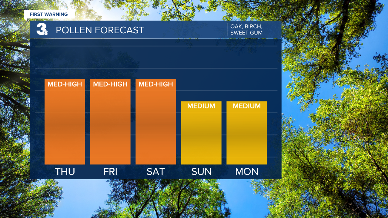
Pollen: Mod-High (Oak, Sweet Gum, Sycamore)
UV Index: 8 (High)
Air Quality: Good (Code Green)
Mosquitoes: Moderate
Weather updates on social media:
Facebook: MylesHendersonWTKR
Instagram: @MylesHendersonWTKR
X (Twitter): @MHendersonWTKR
