


Meteorologist April Loveland's First Warning Forecast
We're one week away from the First Day of Spring, but it will feel more like winter today. Spring-like temperatures move in next week.

The chilly air sticks around today. Highs will only reach the mid 40s, but it will feel more like the upper 30s. We will see lots of sunshine, but it will be deceiving.
Milder weather will build in just in time to start the work week. Expect highs in the low 60s with clouds building in as the day progresses.

Even warmer on Tuesday with highs in the mid and upper 60s under partly cloudy skies.
Mostly cloudy heading into Wednesday. Highs will be in the low 60s. Scattered showers will be possible by the late afternoon and evening hours.

Shower chances will carry into St. Patrick's Day. Temperatures will be in the low 60s.
Another warm up just in time to end the work week. Highs on Friday will soar to the low 70s. Skies will be partly cloudy.
Scattered showers will move in for Saturday with highs in the upper 60s.
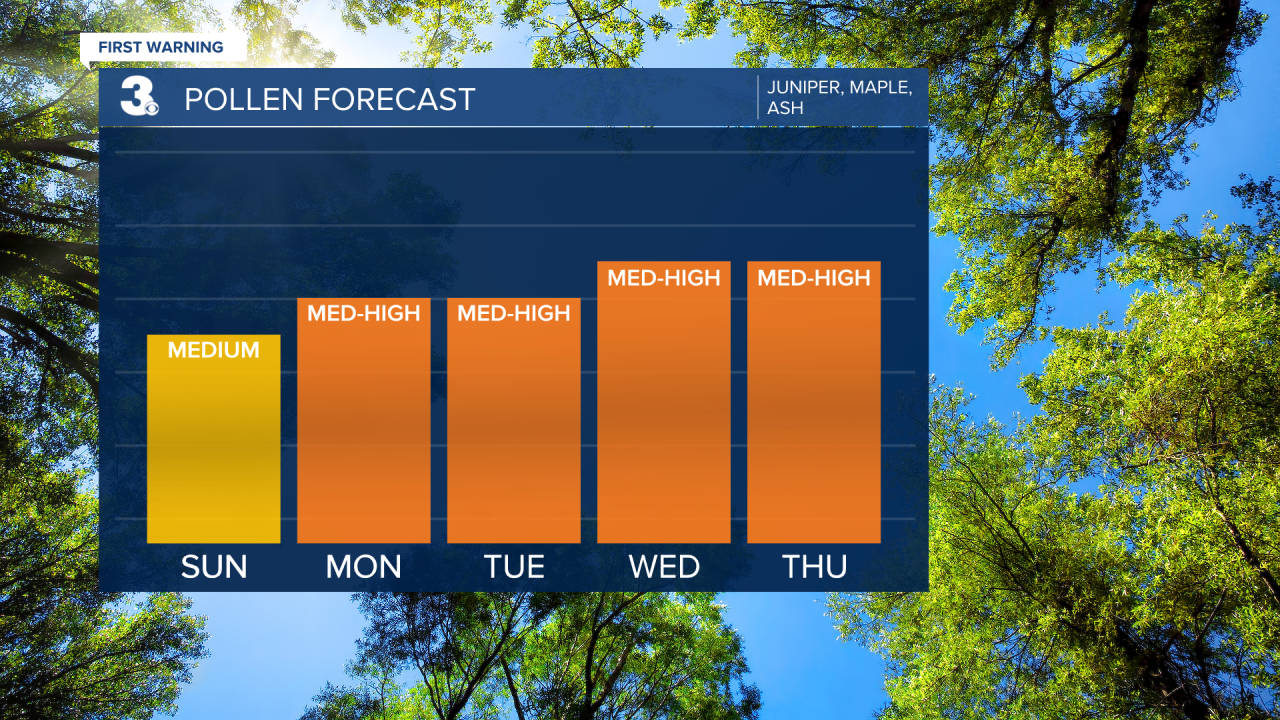
Check out your pollen forecast!
Meteorologist April Loveland
For weather updates on Facebook: HERE
Follow me on Twitter: HERE
Follow me on Instagram HERE
Check out the Interactive Radar on WTKR.com: Interactive Radar
