


Meteorologist Myles Henderson’s First Warning Forecast
More storms to end the work week. Much cooler and less humid for Mother’s Day weekend.
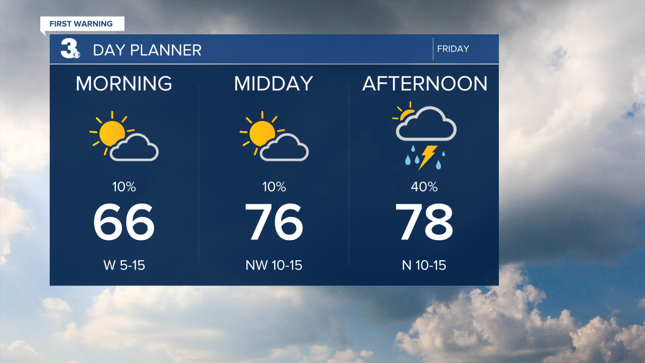
Some sunshine this morning but clouds will build in through midday with scattered showers and storms mixing in this afternoon to evening. Highs will only reach the upper 70s today and the humidity will begin to fall. Watch for the wind to shift from west to north and pick up through the day.
Even cooler this weekend and it will feel more like spring with much lower humidity. Highs will only reach the upper 60s on Saturday and the low 70s on Sunday. We will see a nice mix of sun and clouds with lower rain chances. The biggest rain chance this weekend will be Saturday night.

Highs will level off in the mid to upper 70s for most of next week, near normal for this time of year. We will see more sunshine on Monday, but scattered showers and storms will build in for midweek.
Today: Mix of Clouds, Scattered Storms. Highs in the upper 70s. Winds: W/N 10-15
Tonight: Mostly Cloudy, Scattered Storms. Lows in the mid 50s. Winds: NE 10-15
Tomorrow: Mix of Clouds. Highs in the upper 60s. Winds: NE 5-15
Weather & Health
Pollen: Mod-High (Grasses, Oak, Mulberry)
UV Index: 7 (High)
Air Quality: Good (Code Green)
Mosquitoes: High
Weather updates on social media:
Facebook: MylesHendersonWTKR
Instagram: @MylesHendersonWTKR
X (Twitter): @MHendersonWTKR
