


Chief Meteorologist Patrick Rockey's First Warning Forecast
Get ready for an unsettled weather week —which means showers, thunderstorms and big swings in temperatures. Some of us were awakened by showers and thunderstorms on this Monday morning and more storms are possible on Tuesday and Wednesday.

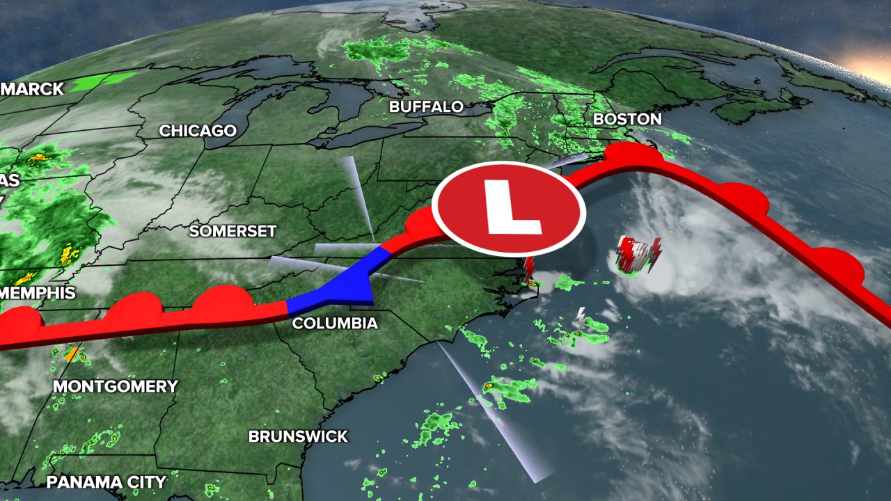
We have a slow-moving front draped across the area which will be the focus for more storms. A few of the storms on Tuesday could be strong or even severe.
And don’t be surprised by a big spread in temperatures. Some of us will only climb into the 60s while others may be flirting with 90 degrees.
On Wednesday, a cold front will cross the region sparking more showers and thunderstorms, especially in the late afternoon and evening.
Before the cold front gets here expect high temperatures near 90 degree in some areas.
Behind the cold front on Thursday some of us may not make it out of the 60s. Thursday is also our best bet for dry weather, with just a 20% chance for a few showers.
Our threat for storms returns on Friday and more wet weather is possible both days this Mother’s Day weekend with another slow-moving storm system.
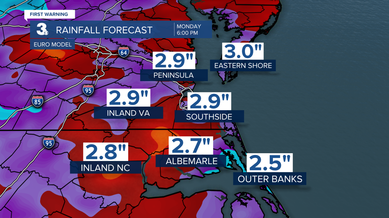
With numerous chances for wet weather, many of us could see 2 to 3 inches of rain over the next week. Keep the umbrella close by.
