


Meteorologist April Loveland's First Warning Forecast
Spring-like weather this week. Expect sunshine and then the chance for strong to severe storms by midweek. A bit of a cool down by the weekend and next week.

Clouds will build in throughout the day and temperatures will warm to the low 70s.
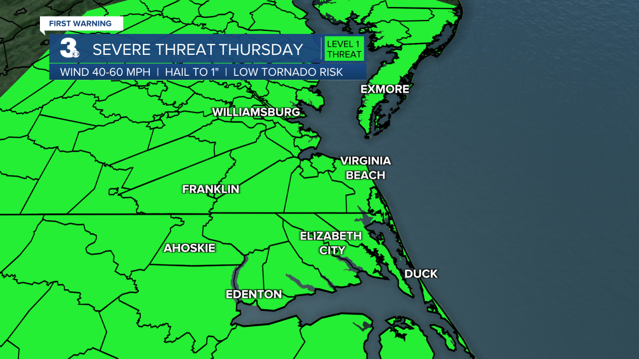
Rain chances will increase midweek as a warm front and cold front impact the area. The cold front will cross Wednesday night into Thursday bringing showers and storms. Storms could become strong to severe. The biggest threats are damaging wind gusts, localized flooding, pockets of hail, and isolated tornadoes.


Rain and storms will continue Thursday. Rain chances will be higher in the morning to midday and dropping by the afternoon to evening. It will still be warm with highs in the low 70s both days.

We'll dry out and cool down to end the work week. Highs will be in the mid 60s, which is still above normal for this time of year.
A few scattered showers will be possible on Saturday. Highs will be in the low 60s on Saturday. Much cooler on Sunday with highs in the mid 50s. It will also be a bit on the windy side.
More sunshine will break out to start the work week. It will still be on the chilly side, with highs in the mid 50s.
Meteorologist April Loveland
For weather updates on Facebook: HERE
Follow me on Twitter: HERE
Follow me on Instagram HERE
Check out the Interactive Radar on WTKR.com: Interactive Radar
