


Meteorologist April Loveland's First Warning Forecast
Even though we will be dealing with several days of wet weather, the temperatures will be very spring-like. Expect highs in the 60s through midweek.
Showers and fog will continue overnight. Temperatures will fall to around 50.
We could see a few lingering showers on Tuesday, with a mix of sun and clouds for the rest of the day. Highs will warm to the low 60s along the coast. We could see highs near the 70 degree mark inland. So if you're heading out to the polls, the weather will cooperate!

We'll deal with another wet day on Wednesday. Expect clouds, rain and storms during the day with highs in the mid 60s.
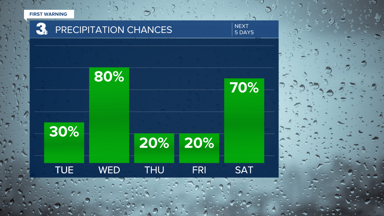
Mostly dry on both Thursday and Friday. Thursday will be milder with highs near 60. It will be a few degrees cooler on Friday with highs in the mid 50s.
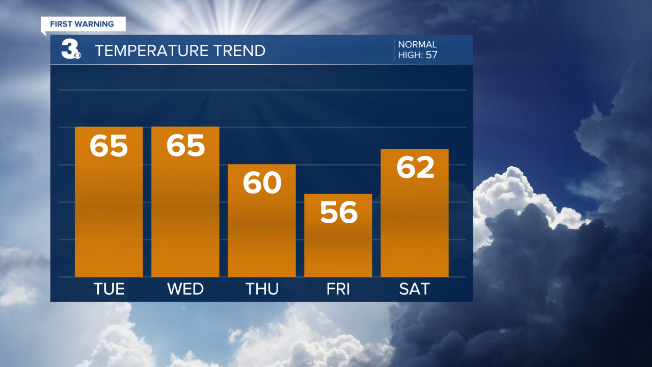
More rain and wind will move in on Saturday. Temperatures will rebound to the low 60s. Showers will linger into Sunday morning. Temperatures will once again warm to the low 60s.
Dry with more sunshine on Monday. Highs will warm to the mid 50s.

Meteorologist April Loveland
For weather updates on Facebook: HERE
Follow me on Twitter: HERE
Follow me on Instagram HERE
Check out the Interactive Radar on WTKR.com: Interactive Radar
