


Meteorologist April Loveland's First Warning Forecast
Punxsutawney Phil saw his shadow, which means six more weeks of winter...even though no matter what we still have 46 more days until Spring.
Clouds have stuck around today along with fog. We've been watching fog come and go especially along the coast. This will keep temperatures down a bit today, but areas that see more sunshine and less fog will be able to warm into the 50s.
Thursday will be the warmest day of the week. We'll start the day with areas of fog. Temperatures will soar into the low 60s. A few spotty showers will be possible. Other than that, not looking too bad. Especially with those spring-like temperatures!
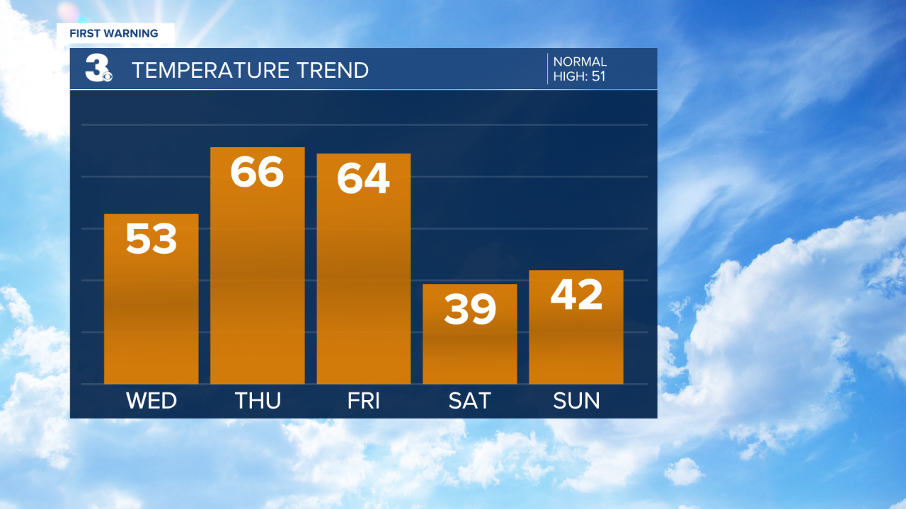
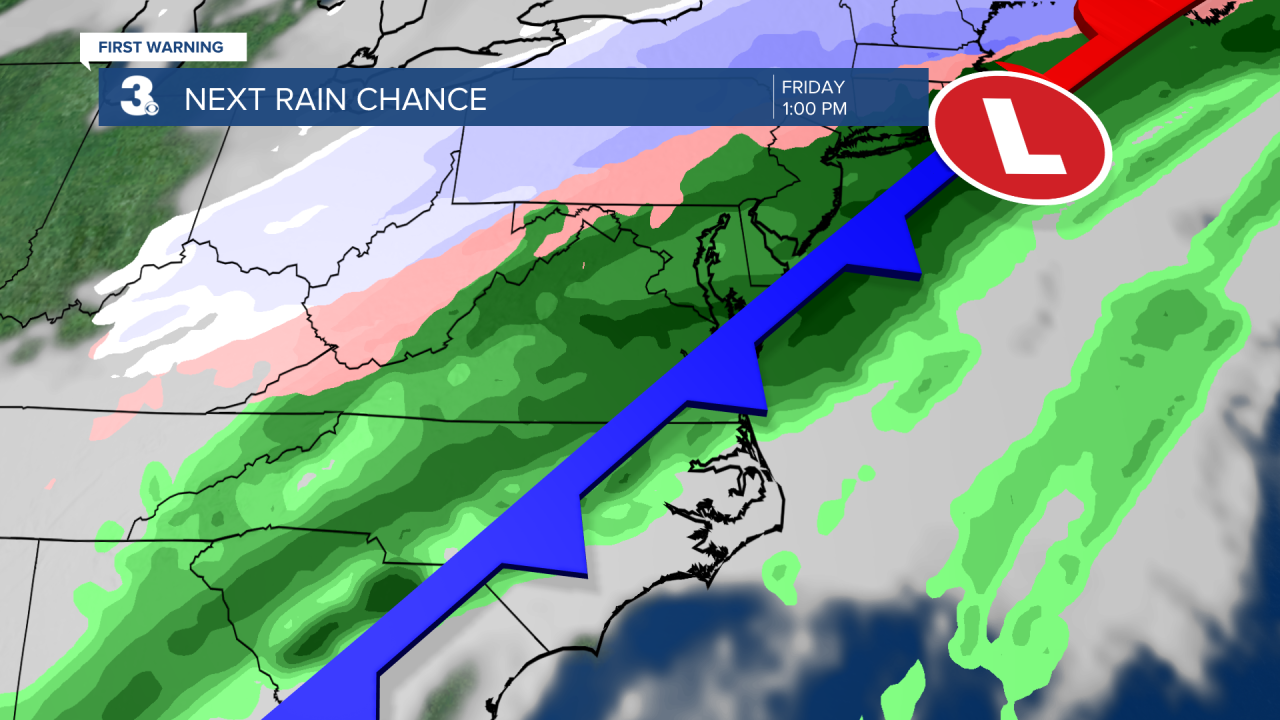
Our next big weather maker moves in just in time to end the work week. Expect rain and wind on Friday. It will still be mild with highs in the low 60s. This is the same system that will bring snow and ice to the Midwest. It will mainly just be a rainmaker for us. Although we could see a brief changeover to sleet and snow as the system exits early Saturday morning.
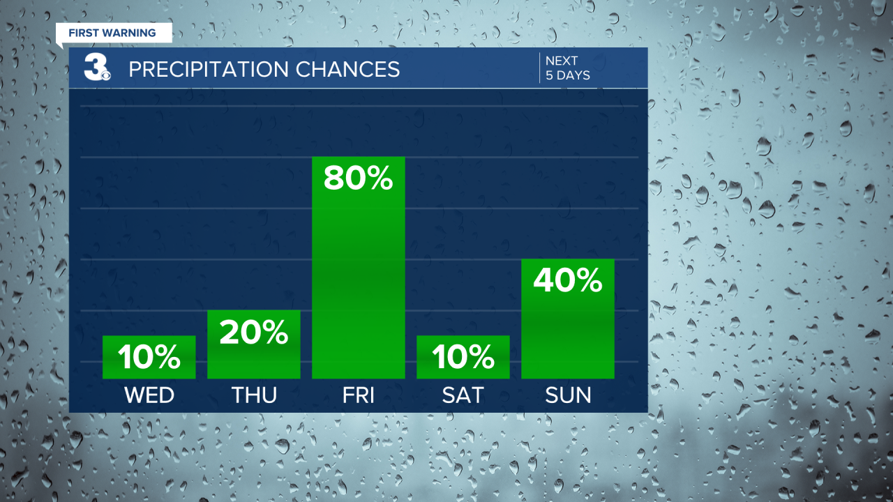
If you're heading out to the Polar Plunge on Saturday, the temperatures will also be taking a plunge. Highs will only warm to the upper 30s, but it's looking dry. There will still be a bit of a breeze making temperatures feel like the 20s.
Precipitation chances will increase on Sunday and Monday, with a chance for a mix of rain, sleet and snow. Some forecast models are even hinting at another chance for snow late Monday and Tuesday. Stay tuned!
Meteorologist April Loveland
For weather updates on Facebook: HERE
Follow me on Twitter: HERE
Follow me on Instagram HERE
Check out the Interactive Radar on WTKR.com: Interactive Radar
