


Meteorologist April Loveland's First Warning Forecast
Below-normal, but dry over the next few days. Warming up and tracking storms by the end of the week.
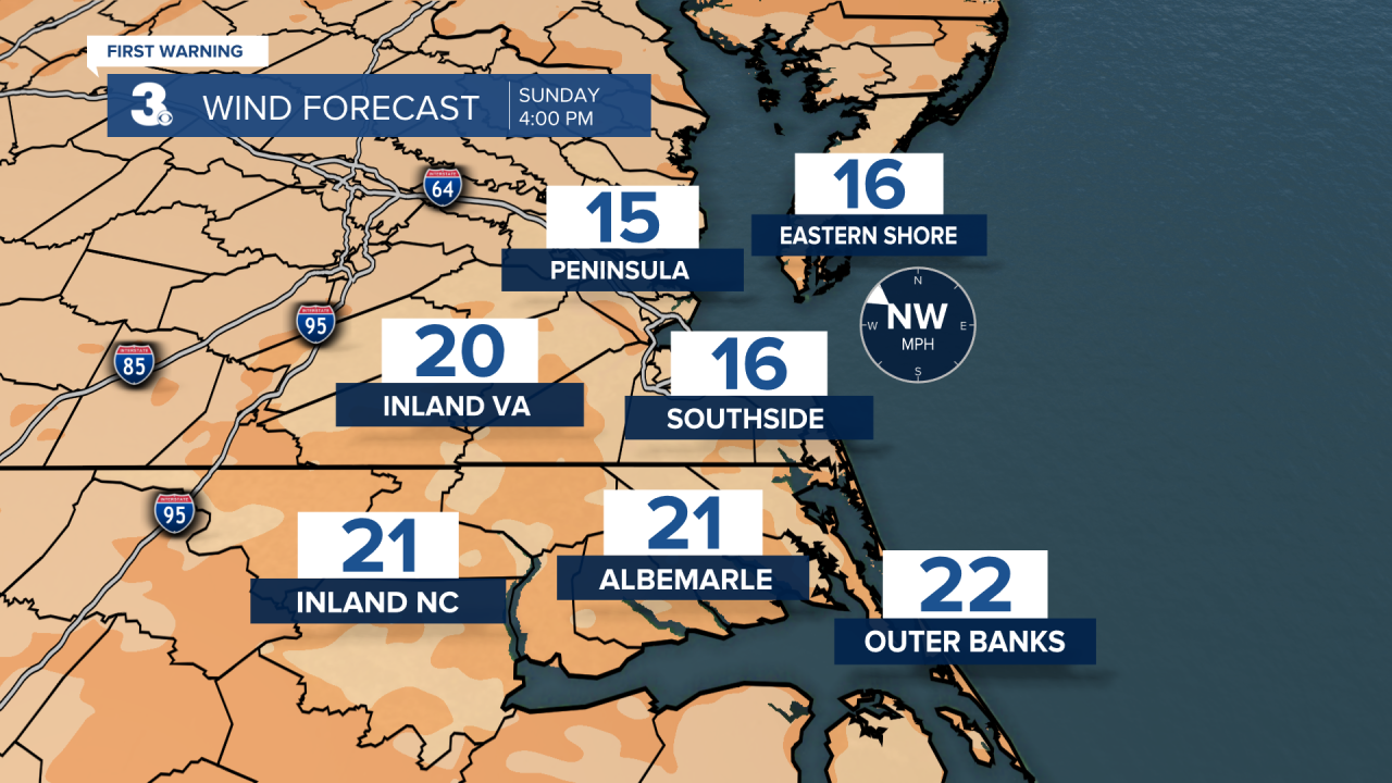
A chilly start on this Sunday, with high temperatures warming to the low and mid 50s. That almost 10 degrees below-normal for this time of year. A few clouds will build in as the day progresses. It will be on the windy side once again. Winds will be out of the west and northwest at 15-20 mph, with higher gusts.
The gusty winds, dry vegetation and low relative humidity, will lead to increased fire danger today and Monday. Remember, open burning is prohibited in Virginia through April 30th.


Skies will be mostly clear overnight and temperatures will plummet into the upper 20s and low 30s. Many areas will get a hard freeze overnight, and you may have to scrape your windshields early Monday.
After a frigid start Monday, temperatures will warm to the low 50s, which is once again, below normal for this time of year. We will see plenty of sunshine.

A frozen start to your Tuesday with many areas falling into the upper 20s. Clouds will build in as the day goes on. Expect highs near 50.
More clouds will be around on Wednesday, but it will be warmer with highs in the mid 60s.
A cold front will cross on Thursday. This will bring the chance for scattered showers and storms. It will also be the warmest day of the week with highs near the 80 degree mark.

A few lingering showers will be possible on Friday, otherwise skies will be partly cloudy with highs in the low 70s.
More sunshine will break out on Saturday with highs in the mid 60s.
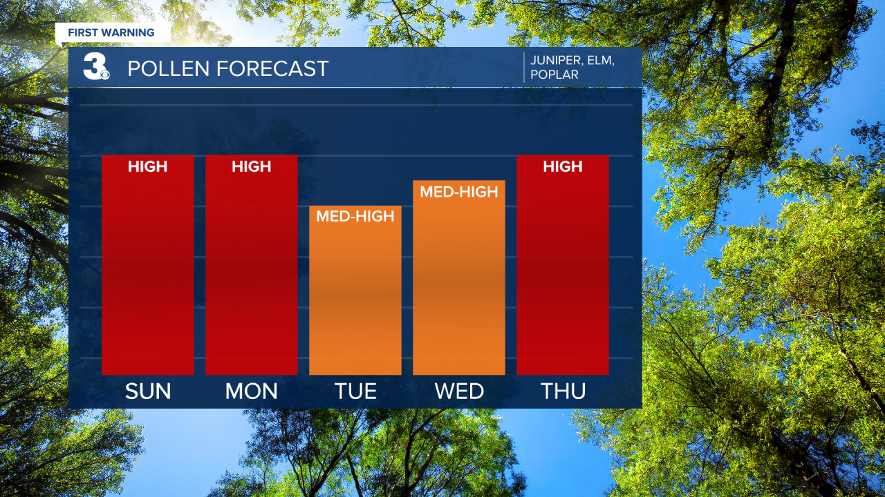
Check out your Pollen Forecast:
Meteorologist April Loveland
For weather updates on Facebook: HERE
Follow me on Twitter: HERE
Follow me on Instagram HERE
Check out the Interactive Radar on WTKR.com: Interactive Radar
