


Meteorologist April Loveland's First Warning Forecast
The last day of winter is bringing some very warm weather.

A cold front will move through this afternoon and evening. This will bring the chance for a few isolated showers or storms. The severe threat continues to diminish, with the best chance across the southern Albemarle and OBX. Otherwise, expect partly cloudy skies and warm conditions. Temperatures will warm to near 80, which is well above normal for this time of year.

Temperatures will drop behind the cold front on Sunday. Even though it will be cooler, temperatures will still be a few degrees above normal. Expect highs in the low and mid 60s under partly cloudy skies.
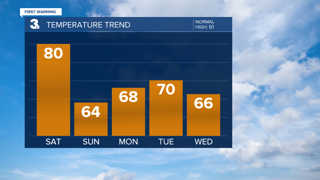
More sunshine will break out just in time to start the work week. Highs will warm to the upper 60s.
Tuesday is looking dry as well. Clouds will build in throughout the day and temperatures will warm to near 70.
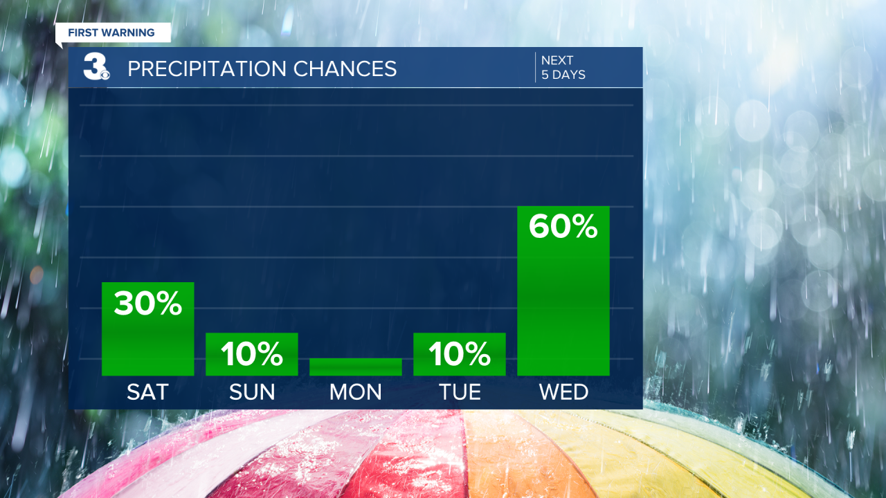
Rain chances will increase midweek as a warm front and cold front impact the area. The cold front will cross Wednesday night into Thursday bringing a chance for showers and storms. Temperatures will be in the mid 60s on Wednesday and low 70s on Thursday.
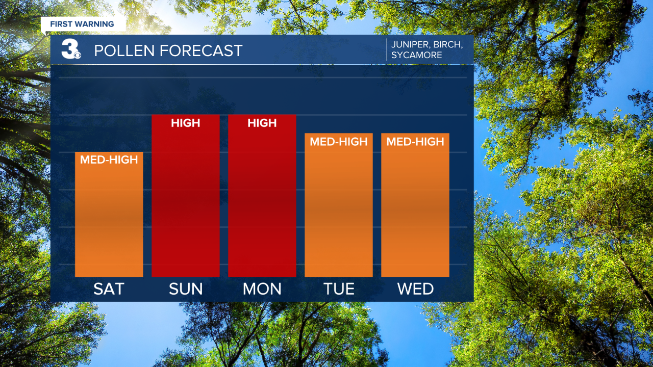
Check out your pollen forecast!
Meteorologist April Loveland
For weather updates on Facebook: HERE
Follow me on Twitter: HERE
Follow me on Instagram HERE
Check out the Interactive Radar on WTKR.com: Interactive Radar
