


Meteorologist April Loveland's First Warning Forecast
A messy day ahead. We're tracking snow, sleet, freezing rain and plain rain along with gusty winds and flooding.
A Winter Weather Advisory is in effect until 6 PM.
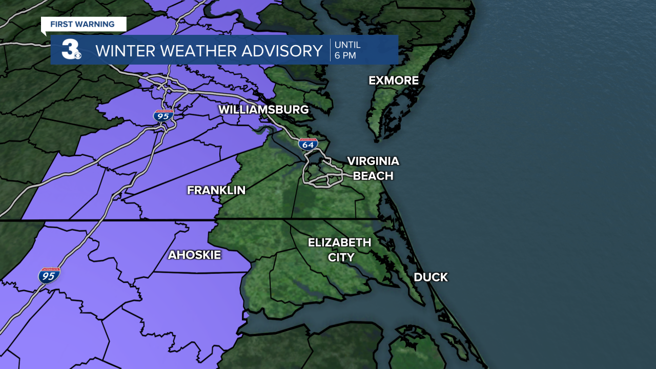
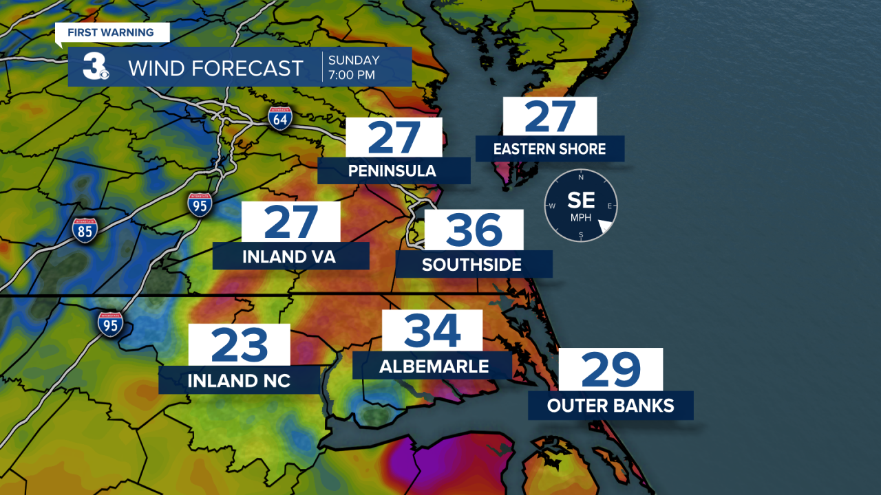
Many areas will start off as snow or sleet and change all to rain by the afternoon. This could make for some slick travel conditions. Temperatures will warm as the day progresses. Highs will be in the 50s by this evening. Winds will crank up through this evening. Expect sustained ENE winds of 20-30 MPH gusting up to 50 MPH. Areas along the coast are under a Wind Advisory from 4 PM Sunday until 10 AM Monday. Isolated power outages, tree limbs knocked down, and unsecured objects being blown around are possible.

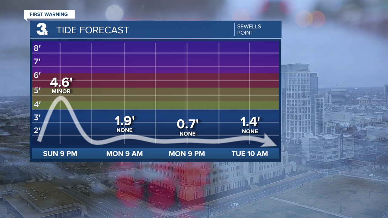
Tidal flooding will also be an issue at high tide this evening. High Tide at Sewells Point is 9 PM.
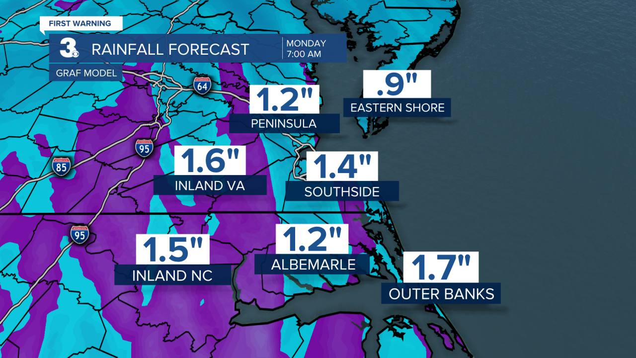
Rain will become heavy at times during the afternoon and evening. Many areas will pick up 1-2 inches of rain. A rumble of thunder will also be possible, mainly along the Outer Banks.
Rain will move out late tonight. We may see a few snow flurries overnight and very early Monday. Not expecting any accumulation. Temperatures will drop into the upper 30s.
Drying out just in time for Martin Luther King Jr. Day. It will still be on the windy side with wind gusts 30-40 mph possible. We'll see partial clearing as the day progresses. Highs will be in the mid and upper 40s.
Plenty of sunshine heading into Tuesday with highs in the mid 40s.
We'll see an almost 10 degree warmup on Wednesday with highs in the low and mid 50s. Skies will be partly cloudy.
Our eyes turn to our next cold front which will move in Thursday morning along with colder air. Skies will be mostly cloudy with the chance for showers. We may even see a little snow mix in late.
Another system will move in for Friday and Saturday. It will be much colder with highs only in the low to mid 30s. Keeping the chance for a few snow showers, but stay tuned for any updates!
Meteorologist April Loveland
For weather updates on Facebook: HERE
Follow me on Twitter: HERE
Follow me on Instagram HERE
Check out the Interactive Radar on WTKR.com: Interactive Radar
