


Meteorologist April Loveland's First Warning Forecast
We'll see a lull in the showers later this afternoon with another round of rain moving in this evening and overnight. It will be another mild day with highs in the mid 60s to near 70 early, with falling temperatures as the day progresses.
Much colder air will arrive from the northwest tonight as the cold front moves offshore. An area of low pressure will form along the cold front bringing a rain/snow mix to the area.
Heavy rain will move in tonight and winds will ramp up. Temperatures will fall into the 40s, so we'll stay as plain rain through early Monday.

4 AM: The snow/sleet line advances and temperatures continue to drop over the area. Most of the area is still looking like rain.
6 AM: The cold air continues to filter in and some snow/sleet is possible in our far northern communities.
8 AM: Rain continues to switch to snow. The Peninsulas, Eastern Shore and inland Virginia and North Carolina should see the changeover.
10 AM: The storm pulls away and colder air filters in. Most areas minus the OBX are seeing either snow or sleet.
Noon: Most of the wet weather should have exited. A few snow showers will still be possible.

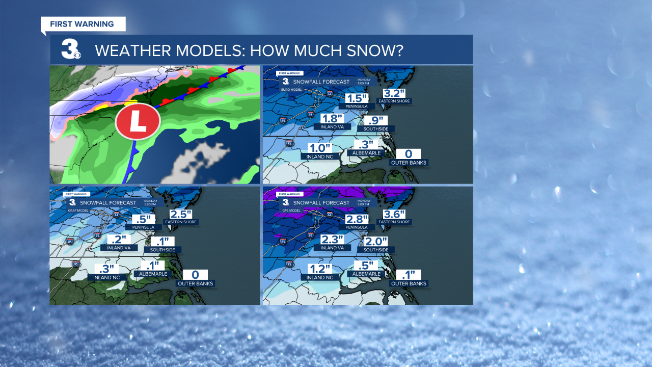
Snow Totals: Some models still hinting at higher amounts. Going will an inch or less for most of the area. The ground will be warm and wet from all the rain. This will reduce snow accumulations.

Quite a bit of rain is expected from now through noontime Monday. Many areas could see 2+ inches.

Even though we're not expecting a ton of snow, it is still going to be a rough morning for commuters! Rain will be coming down and once we see the changeover, the snow will be very wet. This could cause some slushy conditions.
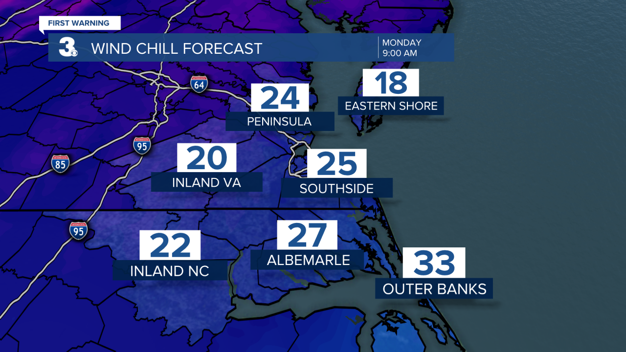
Other things...It will be windy and it will be cold! We have been spoiled with the 70s, but the gusty winds will make temperatures feel like the 20s on Monday!

Mostly clear and frigid overnight. We haven't felt temperatures like this in awhile. Expect lows in the upper 20s and low 30s. Any standing water could turn into black ice.
Finally! Sunshine will break out on Tuesday. It will be deceiving though! Highs will only warm to the mid and upper 40s.
The dry weather will continue on Wednesday with highs in the mid 50s.
More clouds will build in on Thursday. Highs will warm to the mid and upper 50s once again. Showers will be possible late.
We'll continue with a slight chance for showers on Friday. Highs will cool to the upper 40s.
Meteorologist April Loveland
For weather updates on Facebook: HERE
Follow me on Twitter: HERE
Follow me on Instagram HERE
Check out the Interactive Radar on WTKR.com: Interactive Radar
