


Meteorologist Kristy Steward's First Warning Forecast
Good Sunday night! Our severe threat has passed. Fortunately, these storms lost a lot of energy after sunset and we were able to dodge the severe storms. Rain continues tonight, then more rounds of storms as we head throughout the workweek and stay in this unsettled pattern.
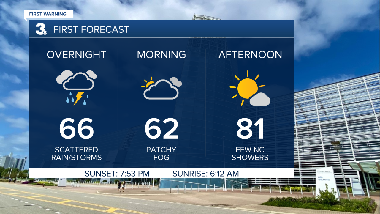
Throughout the rest of tonight scattered showers with embedded storms will persist until sunrise Monday. Areas that see a good amount of rainfall tonight will likely wake up to patchy fog.
High temperatures will be in the low 80s Monday. A few stray showers possible, but much of the day looks dry. Then a cold front Monday evening drops temperatures into the low 70s for Tuesday. Around the front we could have a quick line of showers or storms, mainly across NC. Tuesday evening after 5 PM is when everyone will get the next round of scattered storms. Expect this round to continue until sunrise Wednesday.
Wednesday evening into the night is our third round of scattered storms. These storms have the potential to become strong around a passing cold front. Highs Wednesday in the low 80s again drop to the low 70s Thursday.
We stay in an unsettled pattern Thursday throughout next weekend, but Thursday should be a drier day for us. More scattered storms return Friday afternoon and continue through Saturday. On Saturday, a low pressure system will move across Hampton Roads. Those usually give us storms that need to be watched, so we’ll have to pay attention to the forecast to see what all Saturday could bring. Some lingering showers are possible Sunday, just depending on how quickly that low pressure moves offshore. Behind that system, temperatures do look cooler. Possibly in the upper 60s to end next weekend.

Connect with Meteorologist Kristy Steward:
FACEBOOK
TWITTER
INSTAGRAM
