


Meteorologist April Loveland's First Warning Forecast
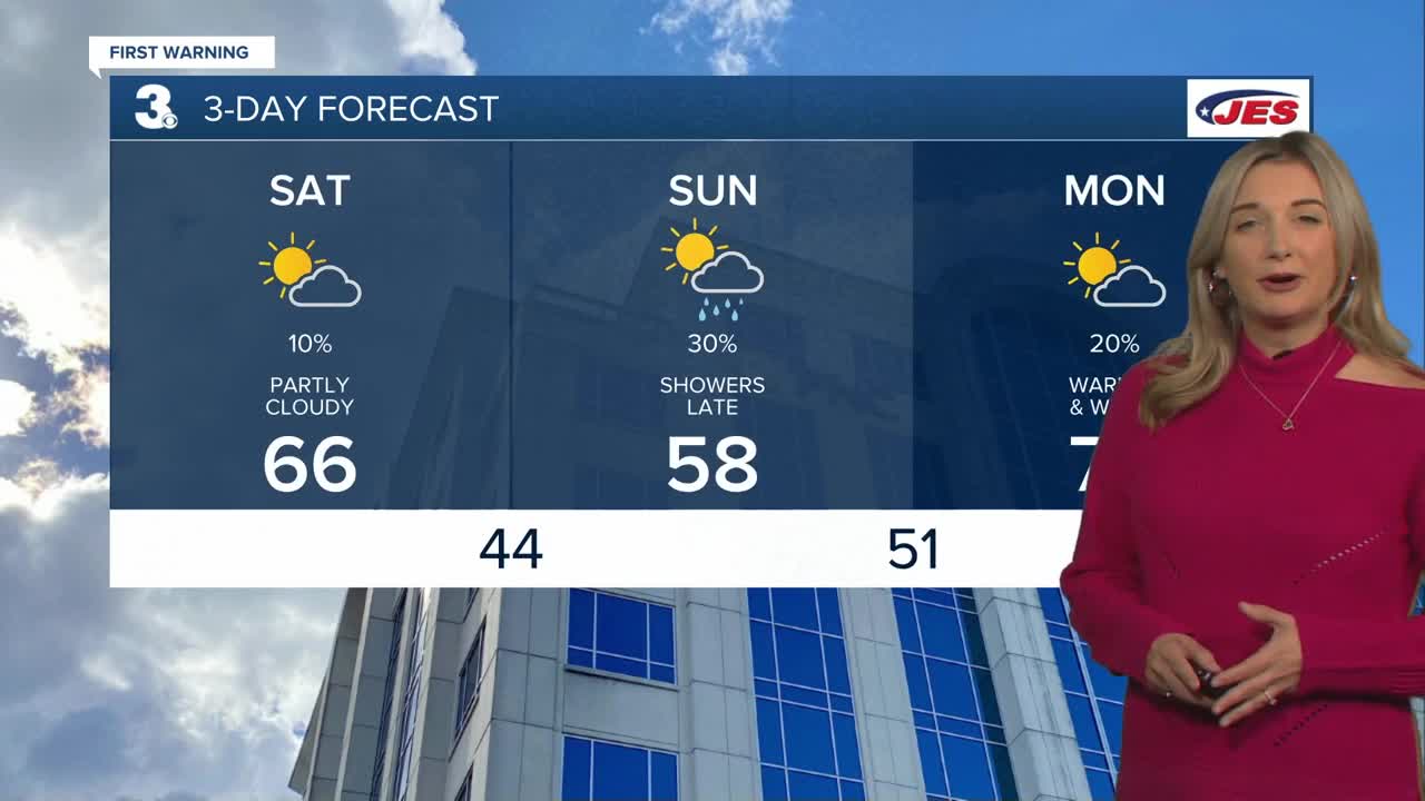
We'll have much of the same as we head through this afternoon with highs ranging from the mid 50s north to near 70 south in North Carolina. Conditions will be dry today under partly cloudy skies. High pressure will build in tonight with lows in the 40s.
More clouds will build in for Sunday. Most of the day will be dry, but a warm front will move in late bringing a chance for a few showers. Highs will warm to the upper 50s.
A big warm up on Monday with highs near 70! It will be partly cloudy and breezy with winds out of the southwest at 10-20 mph, with higher gusts. A strong cold front will move through late, but it is looking mostly dry. We will however see a big temperature drop.
Temperatures will struggle to get out of the 40s on Tuesday. An area of low pressure will approach from the Gulf of Mexico. A few showers will be possible late Tuesday, with widespread rain moving in on Wednesday. Wednesday will be the wettest day of the week. Temperatures will warm to the mid 50s.
Unsettled weather will continue to end the week. Keeping the chance for a spotty shower on both Thursday and Friday. Temperatures will be in the low 50s on Thursday and low 60s on Friday.
Meteorologist April Loveland
For weather updates on Facebook: HERE
Follow me on Twitter: HERE
Follow me on Instagram HERE
Check out the Interactive Radar on WTKR.com: Interactive Radar
