


Meteorologist April Loveland's First Warning Forecast
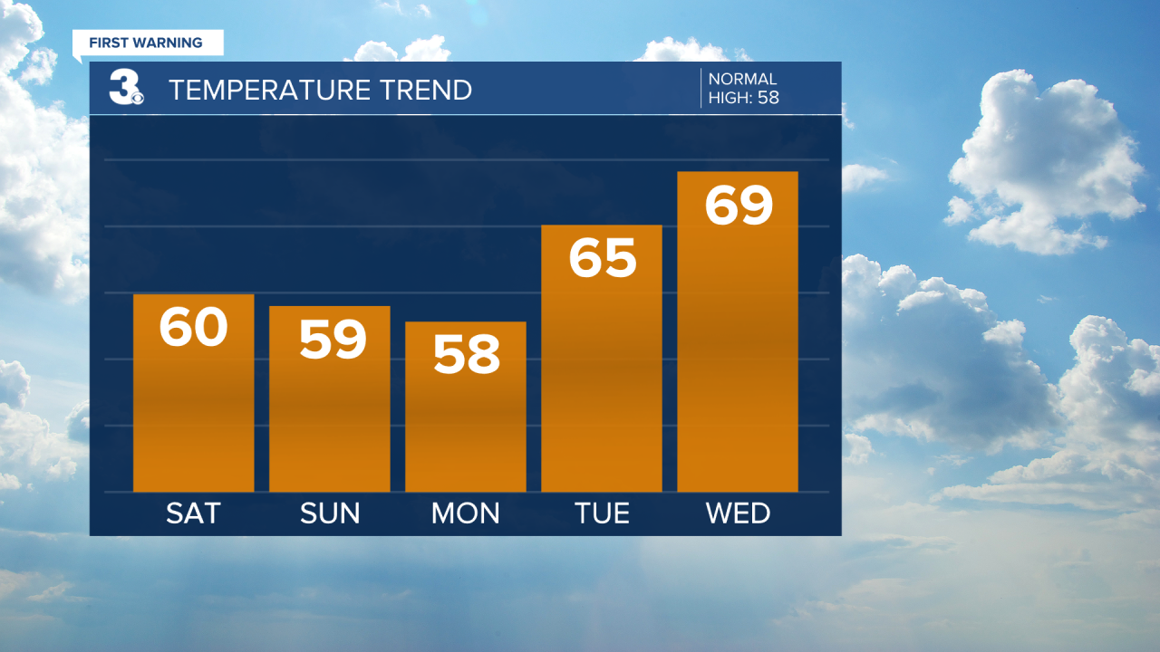
A messy Saturday on tap. Several systems will move through bringing rain, wind, possible storms and flooding. Many areas could potentially see another inch of rain. Winds will be out of the southeast at 20-30 mph, with higher gusts. Coastal Flood Advisories are in place through Sunday. Temperatures will top out in the upper 50s to mid 60s. A strong to severe storm is possible later today along the Albemarle.


Don't forget! Turn your clocks forward 1 hour Sunday at 2 AM. Daylight Saving Time begins.

High pressure will build in on Sunday. This will bring a nice mix of sun and clouds. Temperatures will be in the 50s. It will still be windy with winds out of the west at 15-25 mph. Gusts 30-40 mph will be possible.
Sunny and windy to kick off the work week. Temperatures will trend in the upper 50s. It will be windy! Winds will be out of the northwest at 15-25 mph. Gusts 45-50 mph will be possible.

We'll finally say goodbye to the wind on Tuesday. It's looking like a really nice day with highs in the mid 60s. Skies will be sunny.
The warming trend continues on Wednesday. It will still be dry with highs in the upper 60s. Skies will be partly sunny.
Even warmer on Thursday. Highs will soar to the low 70s.
Scattered showers will be possible Friday afternoon. It will be warm with highs in the low 70s.
Meteorologist April Loveland
For weather updates on Facebook: HERE
Follow me on Twitter: HERE
Follow me on Instagram HERE
Check out the Interactive Radar on WTKR.com: Interactive Radar
