


Chief Meteorologist Patrick Rockey’s First Warning Forecast
We were thankful that the rain on this day after Thanksgiving moved out very quickly and sunshine moved back in. But it was a cooler and breezy Black Friday. And downright frigid weather will be moving in as we kick off the weekend.
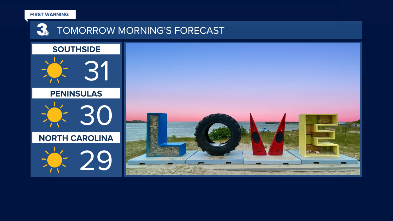
We will start your Saturday with some very cold air. Many of us will wake up to temperatures in the 20s. Most of us will be close to the freezing mark, despite plenty of sunshine. Under clear skies we will only warm into the upper 40s on Saturday.
But a warm front will push through for the second half of the weekend. That will mean an increase in clouds on Sunday along with an increase in temperatures.
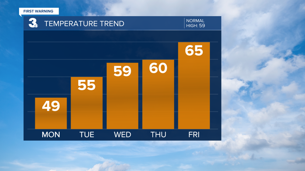
Most of us will top out in the upper 50s and lower 60s. Yet another cold front will move in on Monday, knocking our high temperatures down into the upper 40s under partly cloudy skies.
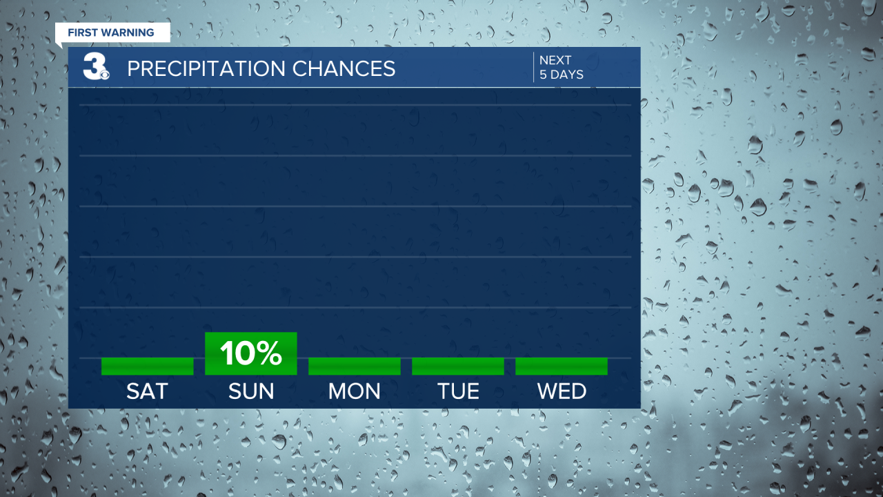
But then we start a warming trend and by Thursday and Friday we expect high temperatures back into the 60s.Unfortunately, we are expecting no rainfall over the next week. Our annual rainfall deficit is now approaching 9 inches!
