


Meteorologist Myles Henderson’s First Warning Forecast
A warm week with highs in the 80s. Several chances for showers and storms this week.
Mostly cloudy with scattered showers this morning. Rain chances will drop through midday with a mix of clouds. Highs will reach the low 80s today. More showers and storms will build in later
this afternoon to evening.

Highs will return to the low 80s tomorrow. We will see a mix of clouds with scattered showers and storms, mainly in the afternoon.

Wednesday will be the warmest day of the week with highs near 90. Expect partly cloudy skies with a lower rain chance.
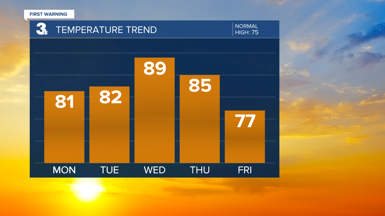
More showers and storm will build in for Thursday and Friday as a cold front moves through the region. Highs will drop from the mid 80s on Thursday to the upper 70s on Friday to the low 70s this weekend.
Today: Mostly Cloudy, Showers & Storms. Highs in the low 80s. Winds: SW 5-10
Tonight: Mostly Cloudy, Showers & Storms. Lows in the upper 60s. Winds: SW 5-10
Tomorrow: Mix of Clouds, Showers & Storms. Highs in the low 80s. Winds: SW 5-10
Weather & Health
Pollen: Low-Mod (Oak, Birch, Poplar)
UV Index: 8 (High)
Air Quality: Good (Code Green)
Mosquitoes: Moderate
Weather updates on social media:
Facebook: MylesHendersonWTKR
Instagram: @MylesHendersonWTKR
X (Twitter): @MHendersonWTKR
