


Meteorologist Kristy Steward's First Warning Forecast
Good Thursday evening! This is our fourth Thursday in a row with a severe threat. We are all under a level 1 out of 5 risk for severe storms this evening into tonight.

Storms really start moving in around 6 PM and continue up until 2 AM. At 6 PM, they’ll be entering inland Virginia and the Peninsulas. 8-10 PM they’ll push through the 7 cities. Then, pass through the Outer Banks around 10 PM - Midnight. Some lingering scattered showers will continue a couple hours after the main line passes through.
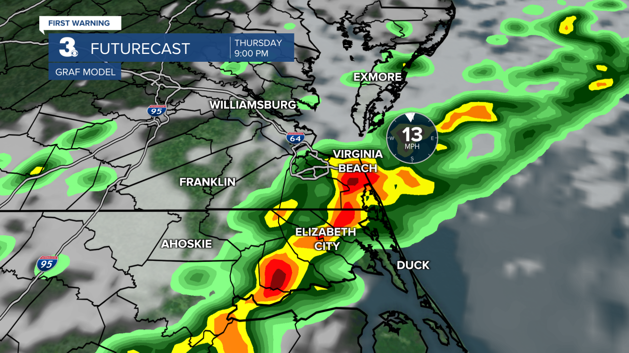
Our main threats are damaging wind gusts, heavy downpours, and localized large hail. Take it slower on the evening commute and secure anything outdoors you don’t want blown away.

Late tonight and early Friday morning, clouds begin to clear out. We’ll wake up to temperatures in the mid 50s. High pressure quickly slides over Hampton Roads Friday, bringing us lots of sunshine. Temperatures will be a bit cooler Friday with highs around the upper 60s.
This weekend, another cold front will pass through. This one won’t be quite as strong. Ahead of the front, clouds increase Saturday and temperatures bump up to the low to mid 70s. The front will pass through Saturday night. Around it, we could have a line of isolated showers near Midnight.
Easter Sunday is looking quite nice! Dry with a mix of sun and clouds, but cooler. Morning services will be in the mid 50s. Highs warm a handful of degrees into the low 60s Sunday afternoon. High temperatures remain in the low 60s, which is about 10° below average for this time of year, through the first half of next week.
An unsettled pattern brings us scattered rain showers Monday into Tuesday morning. High pressure helps us dry out and clear out Wednesday into Thursday. This means we may possibly break our Thursday severe threat streak next week! Temperatures start to warm again Thursday into the low to mid 70s.
Connect with Meteorologist Kristy Steward:
