


Meteorologist Myles Henderson’s First Warning Forecast
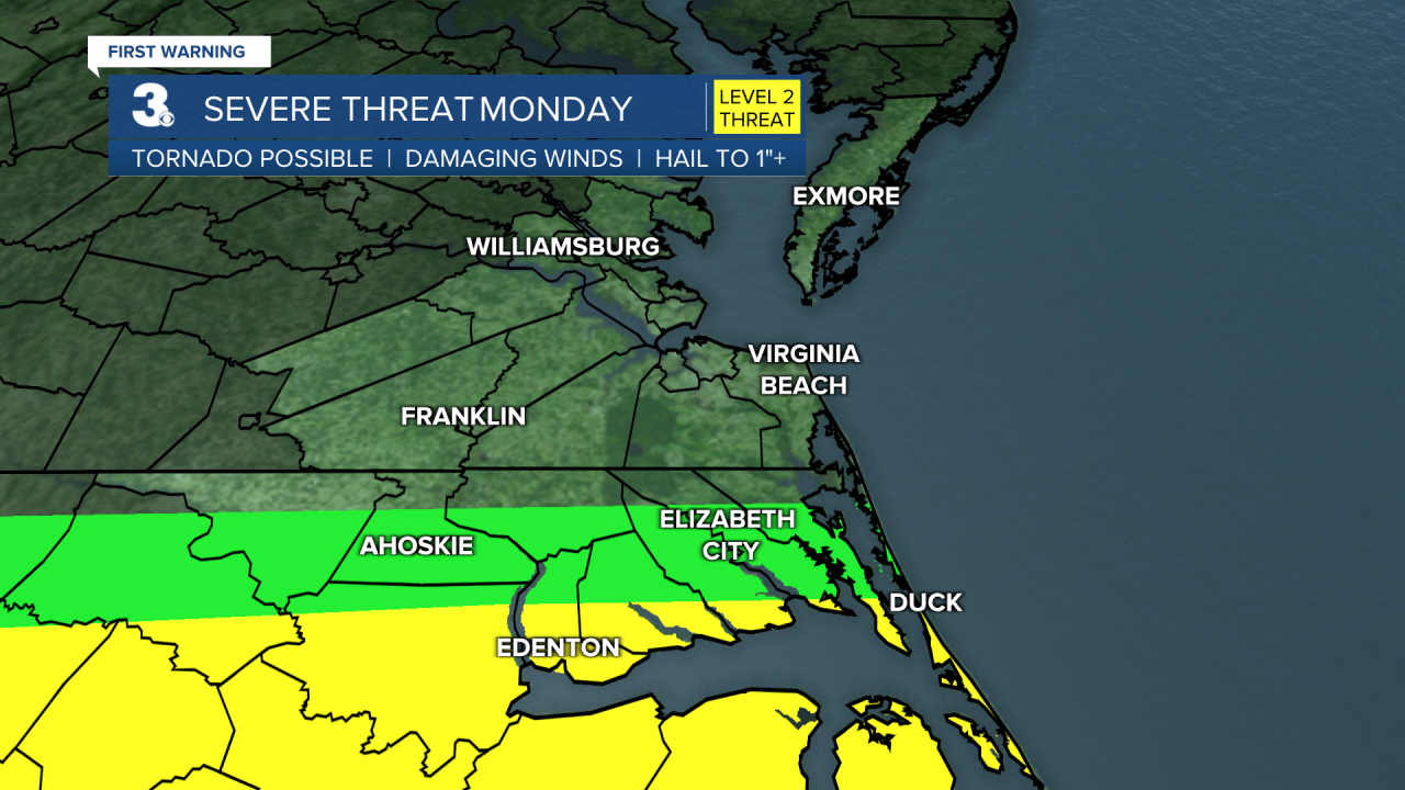
Rain and storms to start the week… A cold front will bring in scattered showers and storms today. Severe storms are possible, mainly in North Carolina. Gusty winds, heavy downpours, hail, and tornadoes are possible. Temperatures will fall from the 70s to the 60s today. Rain chances will taper off this evening and clouds will start to break up overnight.
We will see a mix of sun and clouds Tuesday with a few spotty showers possible. Highs will only reach the upper 60s. More clouds will blend in for Wednesday with highs in the mid 60s, about 10 degrees below normal for this time of year. We will warm to the upper 60s again on Thursday.
Another round of rain is possible on Friday as an area of low pressure tracks to our south. Highs will warm back to the 70s Friday and this weekend.
Today: Mostly Cloudy, Showers/Storms. Highs in the low 70s. Winds: SW/N 10-15
Tonight: Partly Cloudy. Lows in the mid 50s. Winds: N 5-10
Tomorrow: Partly Cloudy, Stray Showers. Highs in the upper 60s. Winds: NE/S 5-15
Weather & Health
Pollen: Low-Medium (Oak, Birch, Poplar)
UV Index: 2 (Low)
Air Quality: Good (Code Green)
Mosquitoes: Low-Moderate
Weather updates on social media:
Facebook: MylesHendersonWTKR
Twitter: @MHendersonWTKR
Instagram: @MylesHendersonWTKR
