


Meteorologist April Loveland's First Warning Forecast
Warming temperatures, severe storms, then finally drying out. We're just 37 days away from the First Day of Summer and temperatures will start looking like it!

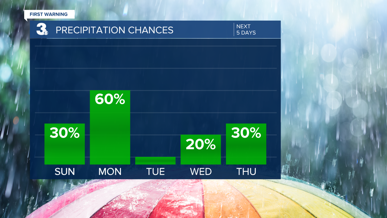
A disturbance will move through today bringing a chance for a couple showers and storms this evening and overnight, but it is looking like the pick of the weekend. Temperature will warm to the low 80s. Expect a mix of sun and clouds.

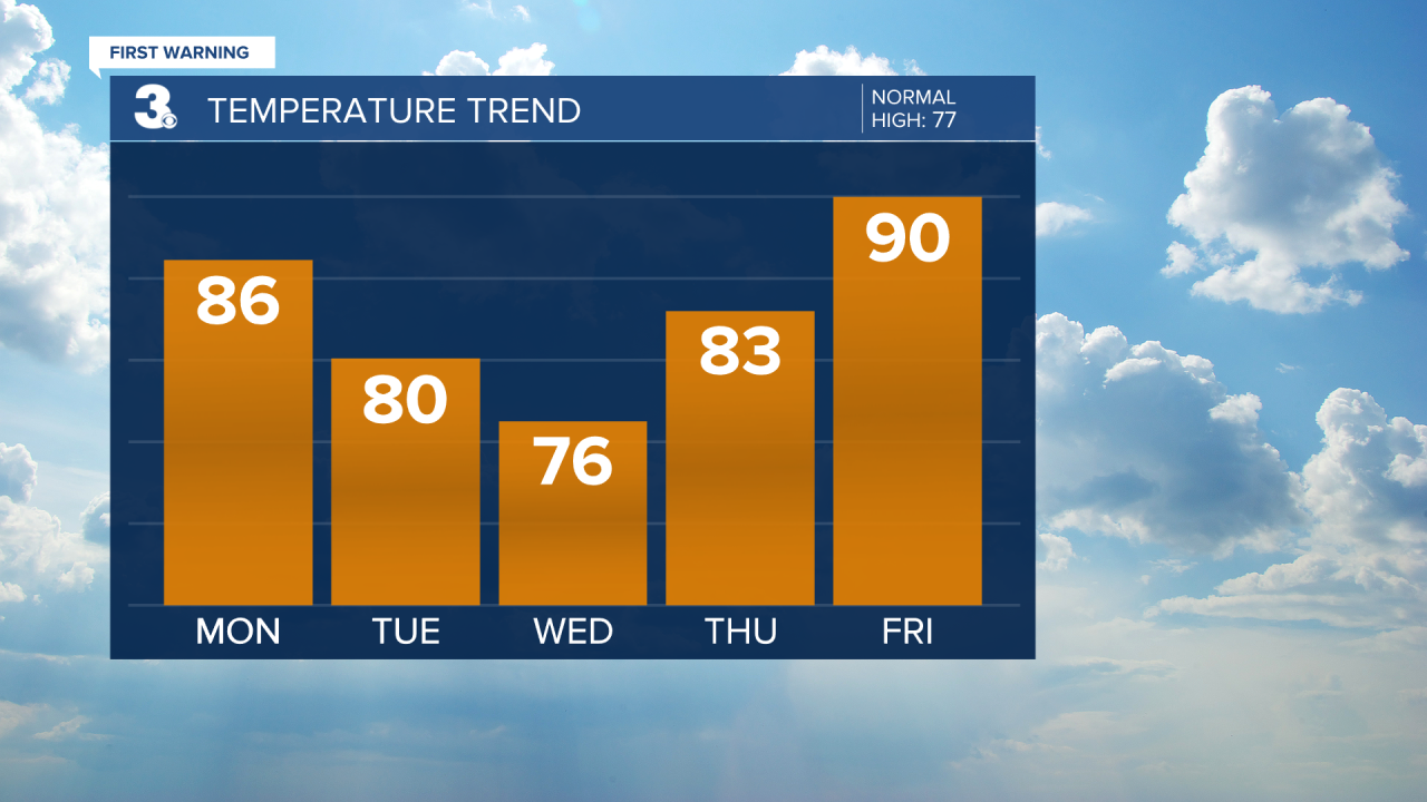
A cold front will impact the area on Monday. This will bring showers and storms to the area Monday afternoon and evening. These storms could be severe. The entire area is under a level 2 for severe storms. The biggest threat will be damaging wind gusts, heavy rain and an isolated tornado. Temperatures will warm to the mid 80s.

High pressure will finally make an appearance on Tuesday and Wednesday. Some much needed sunshine will break out across the area.Expect highs near 80. A few more clouds will build in on
Wednesday, but it's still looking dry with highs in the mid and upper 70s, which is normal for this time of year.
Widely scattered storms are possible on Thursday. Temperatures will warm back to the low 80s.
A big warm up to end the week with highs near 90!
Temperatures will continue to trend near 90 on Saturday under partly cloudy skies.
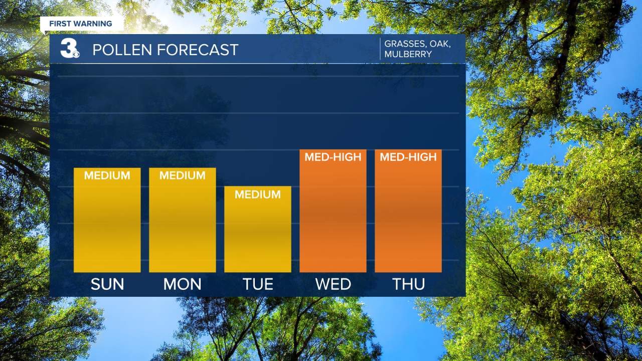
Check out your Pollen Forecast:
Meteorologist April Loveland
For weather updates on Facebook: HERE
Follow me on Twitter: HERE
Follow me on Instagram HERE
Check out the Interactive Radar on WTKR.com: Interactive Radar
