

Chief Meteorologist Patrick Rockey's First Warning Forecast
Just two weeks until the start of winter but you would never know it by today’s high temperatures. Most of us made it into the upper 60s and a few of us actually hit the 70° mark.
Wednesday will bring more spring-like weather and a few more showers.
We will wake up to temperatures in the lower 60s and climb to near 70° in the afternoon.

But there will be plenty of clouds around and a 30 to 40% chance for rain.
After tomorrow, temperatures start to fall.

Expect a mix of clouds and some sunshine on Thursday with high temperatures back in the mid-to-upper 50s, which is close to normal.
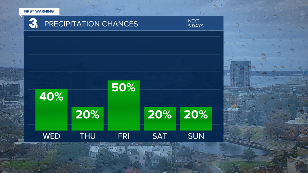
A cold front will bring more clouds and rain on Friday and a drop in temperatures. We expect to top out in the low-to-mid 50s, which is a few degrees below normal.
And that is a sign of things to come for the weekend. Expect plenty of clouds both Saturday and Sunday with high temperatures slightly below normal in the low-to-mid 50s.
Sunshine returns on Monday but the spring temperatures do not. It looks like we will can expect highs in the lower 50s.
