


Meteorologist Kristy Steward's First Warning Forecast
Good Thursday night! On land, it was a nice Fall-like day, but it was rough on the water. A rough surf and tidal flooding persists into the weekend. Next week, our weather pattern shifts and temperatures increase along with rain chances.
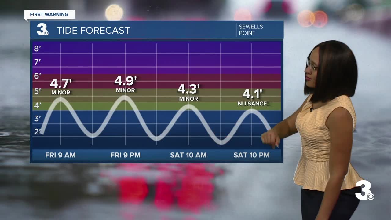
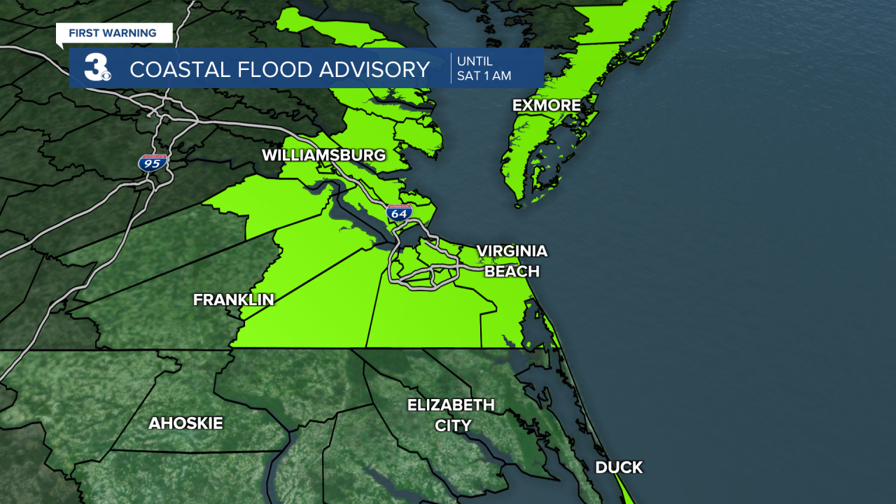
Our current tidal flooding is stemming from Hurricane Earl in the middle of the Atlantic and a weakening coastal low just offshore. Expect minor tidal flooding with 1 foot inundation during high tide cycles Friday. A Coastal Flood Advisory is in effect until 1 AM Saturday.
On Saturday, we’ll go from minor to nuisance tidal flooding as strong northeast winds shift and become southeasterly.

Hurricane Earl is also bringing us a very rough surf. Red flags are flying and swimming is not recommended with 5-8 feet waves in the Atlantic.

Plenty of sunshine and mostly dry Friday. Waking up to temperatures in the upper 60s. Highs stay in the low 80s. Clouds start to build a little Saturday ahead of an approaching system.
Ahead of a front, temperatures rise a couple degrees into the mid 80s Sunday. Showers start to move in on Sunday and become more scattered around the front Monday into Tuesday. Rain tapers off Wednesday and lots of sunshine returns Thursday. While a “cold” front passes through late Tuesday, high temperatures will remain untouched in the mid 80s.
Tropical Update:
Hurricane Earl is now back down to a Category 1 hurricane with 90 MPH sustained winds. It’s located 95 miles SE of Bermuda and is moving NNE at 15 MPH. Earl is forecast to remain in the Atlantic, eventually strengthening into a Category 3 hurricane by Friday. It will bring us a rough surf through the weekend. Bermuda will feel tropical-storm-force winds into Friday.

There are two additional areas currently being watched. One area of low pressure in the middle of the tropics has a 60% chance of formation in the next 48 hours. Another area of low pressure over the west coast of Africa has a 30% chance of formation in the next 5 days. The next name on the list is Fiona.

Connect with Meteorologist Kristy Steward:
FACEBOOK
TWITTER
INSTAGRAM
