


Meteorologist April Loveland's First Warning Forecast
A cold front will move in on Wednesday. This will bring the chance for a few showers during the morning, with better chances for showers and storms during the afternoon. Temperatures will warm to the upper 70s.

Areas of fog will be possible late Wednesday into early Thursday. You'll want to give yourself some extra time heading to work. Temperatures will be warm with highs in the upper 70s along the coast and then into the 80s inland.
Skies will be partly cloudy to end the work week. Temperatures will top out in the mid 70s.
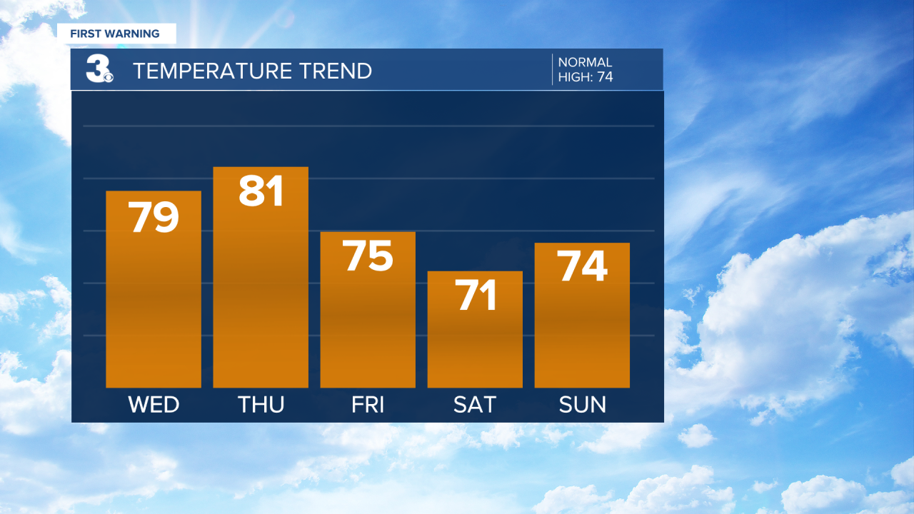
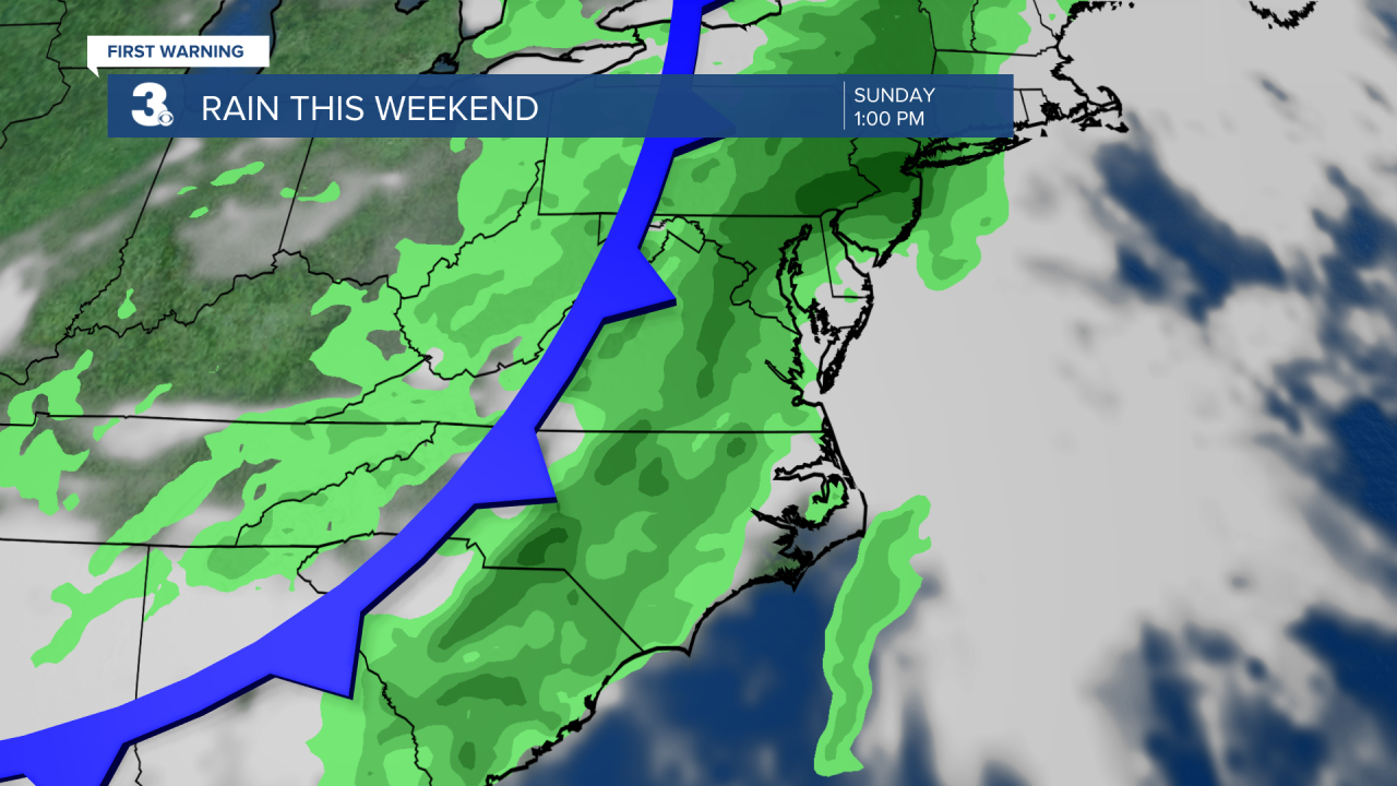
Another cold front will move in for the weekend. Showers and storms will be possible by Saturday afternoon and evening. Temperatures will be cooler, with highs in the upper 60s and low 70s. Scattered showers will be possible again on Sunday. Temperatures will warm to the low 70s.
The unsettled stretch of weather will continue into Monday and Tuesday. Temperatures will trend warmer on Monday with highs in the low 80s. A few storms will be possible during the afternoon. Highs will be in the upper 70s on Tuesday with another chance for a few showers or storms.

Meteorologist April Loveland
For weather updates on Facebook: HERE
Follow me on Twitter: HERE
Follow me on Instagram HERE
Check out the Interactive Radar on WTKR.com: Interactive Radar
