


Meteorologist April Loveland's First Warning Forecast
The unsettled weather pattern will stick around through midweek.
A few showers and storms will be possible through early Tuesday. Patchy fog will also be possible. Temperatures will fall into the 50s.

A strong to severe storm cannot be ruled out early Tuesday. Expect more clouds than sunshine with a wide range of high temperatures once again. Most areas will make it to the upper 70s.
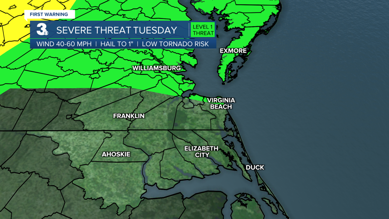
Better chances for showers and storms on Wednesday as a cold front approaches and crosses the area. The entire area is under a Level 1 for severe storms. The biggest threat will be damaging wind gusts and large hail. Temperatures will warm to the mid 70s.

The cold front will not only bring wet weather, but will bring a big drop in temperatures.

Once we get past Wednesday, temperatures will trend in the 50s, which is below normal for this time of year. The weather is looking dry and breezy with partly to mostly sunny skies.
The weekend is looking dry and cool with highs in the 50s.
Pollen Forecast:


Meteorologist April Loveland
For weather updates on Facebook: HERE
Follow me on Twitter: HERE
Follow me on Instagram HERE
Check out the Interactive Radar on WTKR.com: Interactive Radar
