

Meteorologist April Loveland's First Warning Forecast
Clouds will increase this evening with a chance of showers and storms late tonight and early Monday as a cold front moves through the area. The best chance to see showers and storms is north of I64. The Storm Prediction Center does have that area under a level 1 for severe storms, so an isolated severe storm is not out of the question. The biggest threat will be hail and damaging wind gusts. Temperatures will be mild overnight with lows in the low 60s.
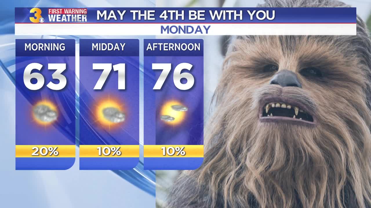
High pressure will build in on Monday. We'll start the day with some clouds, followed by drier and clearer weather. Expect highs in the mid 70s. May the 4th be with you!
Much cooler on Tuesday with highs in the upper 50s to near 60. An area of low pressure will move just to our south giving us showers throughout the day. Temperatures will only drop to the low 50s overnight. A cold front will move through on Wednesday giving us yet another chance for some showers. Highs will be milder in the upper 60s. We'll keep a slight chance for some morning showers on Thursday, but should dry out as the day goes on. Expect highs in the mid 60s. Temperatures will start trending colder overnight as lows dip into the 40s Friday, Saturday and Sunday mornings. Partly cloudy skies on Friday with highs in the upper 60s. An area of low pressure will move through late with a slight chance for showers. Much cooler on Saturday with highs near 60. As of now we're looking dry for Mother's Day. Skies will be mostly sunny with highs in the mid 60s.
Meteorologist April Loveland
For weather updates on Facebook: HERE
Follow me on Twitter: HERE
Follow me on Instagram HERE
Check out the Interactive Radar on WTKR.com: Interactive Radar
