


Meteorologist April Loveland's First Warning Forecast
A warming trend is on the way, along with an unsettled stretch of weather.
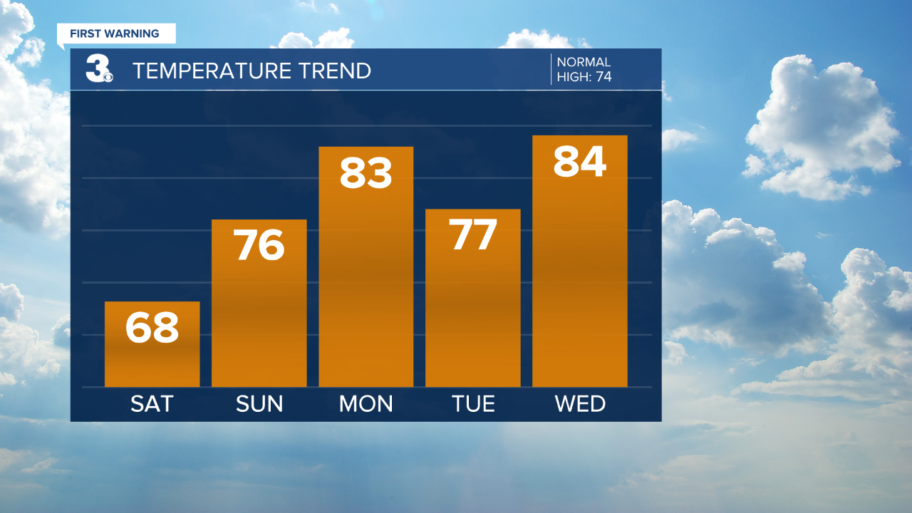
Today will feature a mix of sun and clouds and highs in the mid and upper 60s. Temperatures will still trend below-normal, but conditions are looking dry.
A weak front will lift over the area on Sunday. A few showers will be possible overnight tonight and Sunday morning, followed by better chances for showers and storms by Sunday late afternoon and evening. Temperatures will warm to the mid 70s.
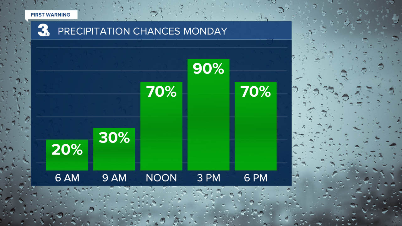
Even warmer to kick off the work week. Many communities will soar into the low 80s. A few lingering morning showers will be possible. After that, expect clearing skies.
A weak disturbance will move through on Tuesday bringing the chance for a few spotty showers or storms. Highs will be in the mid 70s.
Better chance for showers and storms on Wednesday as a cold front approaches. It will be the warmest day of the week with highs in the low and mid 80s. We will have to watch out for a severe threat potential. We will continue to keep an eye on this.
Cooler and drier on Thursday with highs in the low 70s under partly cloudy skies.
Shower chances will increase by Friday afternoon with highs in the mid 70s.
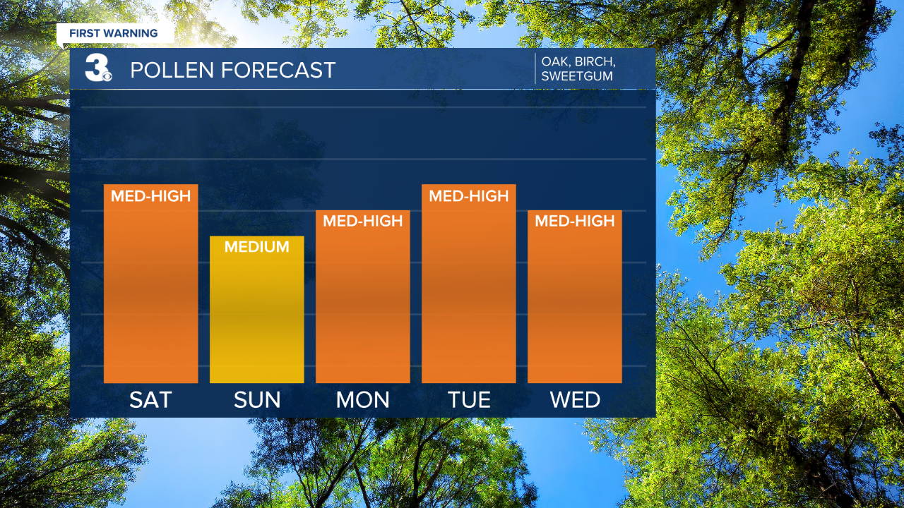
Check out your Pollen Forecast:
Meteorologist April Loveland
For weather updates on Facebook: HERE
Follow me on Twitter: HERE
Follow me on Instagram HERE
Check out the Interactive Radar on WTKR.com: Interactive Radar
