


Meteorologist April Loveland's First Warning Forecast
**WINTER WEATHER ADVISORY in effect from midnight until 9AM Thursday.
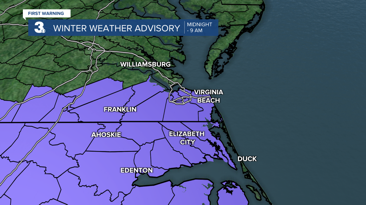
Rain will move in tonight as an area of low pressure moves northeast up the coast of the Carolinas. Temperatures will fall into the 30s overnight with many communities either at or just above the freezing mark.
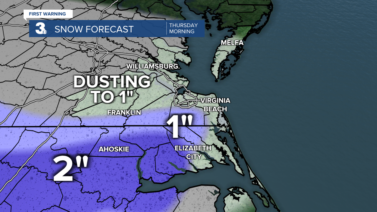
A changeover to a wintry mix of snow will be possible overnight into Thursday morning. The best chance for a switch over will be between 3-5 AM. Right now, most areas could see an inch or less of snow. With amounts climbing toward 2 inches in North Carolina.
The area of low pressure will exit the coast quickly Thursday morning with another disturbance moving through. Dry air will rush in behind these two systems and high pressure will build in. We should see much drier weather after noontime. We're not only dealing with the chance for some wintry weather, but also strong winds.
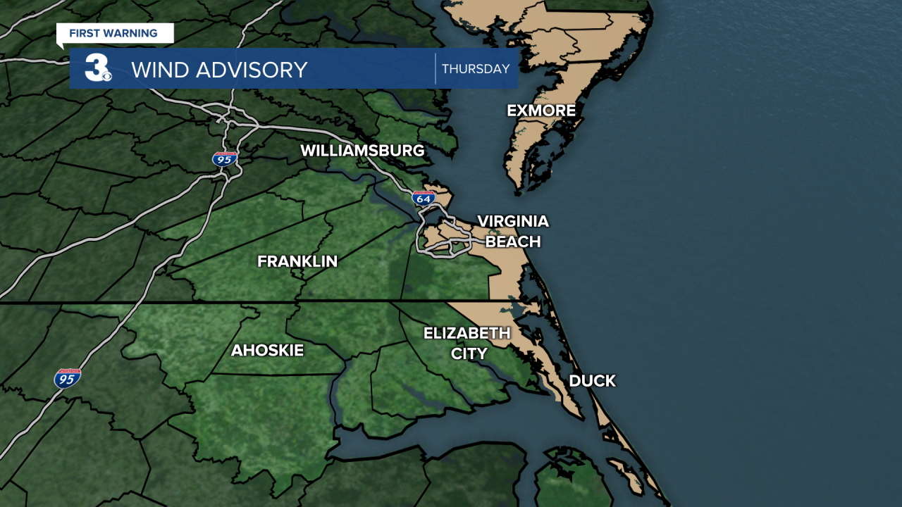
A Wind Advisory is in affect for Thursday. Northwest winds 20-30 mph, with gusts up to 45 mph possible.
Impacts: Gusty winds could blow around unsecured objects.Tree limbs could be blown down and a few power outages may result. This will make our high temperatures in the upper 30s feel closer to the 20s.
Frigid overnight with lows in the mid 20s with wind chills in the teens.
A frigid, but dry end to the work week. It will still be windy with a brisk north/northwest wind. Expect plenty of deceiving sunshine. Highs will be in the upper 30s with wind chills in the 20s. Brr! Even colder overnight as temperatures fall into the mid 20s.
Saturday is looking dry with highs in the upper 30s under partly cloudy skies.
Not as frigid on Sunday with highs in the upper 40s with a few morning snowflakes followed by rain showers.
A few morning showers to kick off the work week with highs in the low and mid 40s. Monday night will be very cold with lows in the upper 20s.
Mostly cloudy heading into Tuesday with highs in the mid 40s.
Meteorologist April Loveland
For weather updates on Facebook: HERE
Follow me on Twitter: HERE
Follow me on Instagram HERE
Check out the Interactive Radar on WTKR.com: Interactive Radar
