

Meteorologist April Loveland's First Warning Forecast
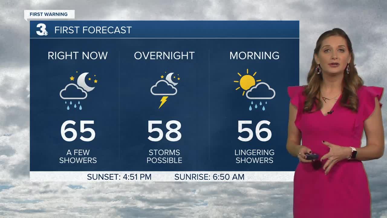
A cold front will push through the area tonight bringing showers and possible storms. The best chance will be after 9 pm and overnight. Temperatures will be mild overnight with temperatures staying steady in the upper 50s to near 60. Once the cold front moves through Monday morning, temperatures will drop into the mid 50s. High pressure will move in behind the cold front with clearing skies by the afternoon. It will be cooler with highs in the upper 50s to near 60. It will also be a bit on the windy side with northwesterly winds at 15-20, with gusts up to 30 mph. Cold overnight Monday with lows dipping into the 30s.
A chilly Tuesday on tap with highs in the upper 40s and low 50s. This will be our chilliest day of the week. Expect wall-to-wall sunshine and light northerly winds.
Temperatures will begin to warm on Wednesday as the area of high pressure moves offshore, and our next system moves in. Temperatures will warm to the low 60s. Rain will move in late as an area of low pressure moves through. Expect rain for at least the morning hours on Thanksgiving. The entire day will not be a washout though. Temperatures will warm to the upper 60s, with a few 70s not out of the question. Sunshine should break out by the afternoon. Skies will be mostly cloudy to end the work week with highs in the low and mid 60s.
Some wet weather could move in for the weekend. Right now, Sunday is looking the wettest with some scattered showers. Both days will see highs in the low 60s.
Tropical Update:
A non-tropical area of low pressure has formed a couple of hundred miles east of the southeastern Bahamas. The associated shower and thunderstorm activity remains disorganized and extends over a broad area mainly to the east of the low. There is a slight chance that the system could acquire some subtropical characteristicsas it moves northeastward over the next day or so. However, on Tuesday the disturbance is expected to merge with a cold front. Later in the week, this system may have a second opportunity to develop subtropical characteristics if it becomes separated from the front and meanders over the central Atlantic.
* Formation chance through 48 hours: LOW (10%)
* Formation chance through 5 days: LOW (20%)
Meteorologist April Loveland
For weather updates on Facebook: HERE
Follow me on Twitter: HERE
Follow me on Instagram HERE
Check out the Interactive Radar on WTKR.com: Interactive Radar
