


Chief Meteorologist Patrick Rockey's First Warning Forecast
After nine straight days of below-normal temperatures, heat rolled in on Sunday and it looks like it's planning to stick around for a few days.
A powerful warm front crossed the region early Sunday, sending the mercury soaring well into the 80s for many of us. And it looks like Monday and Tuesday will be even warmer.
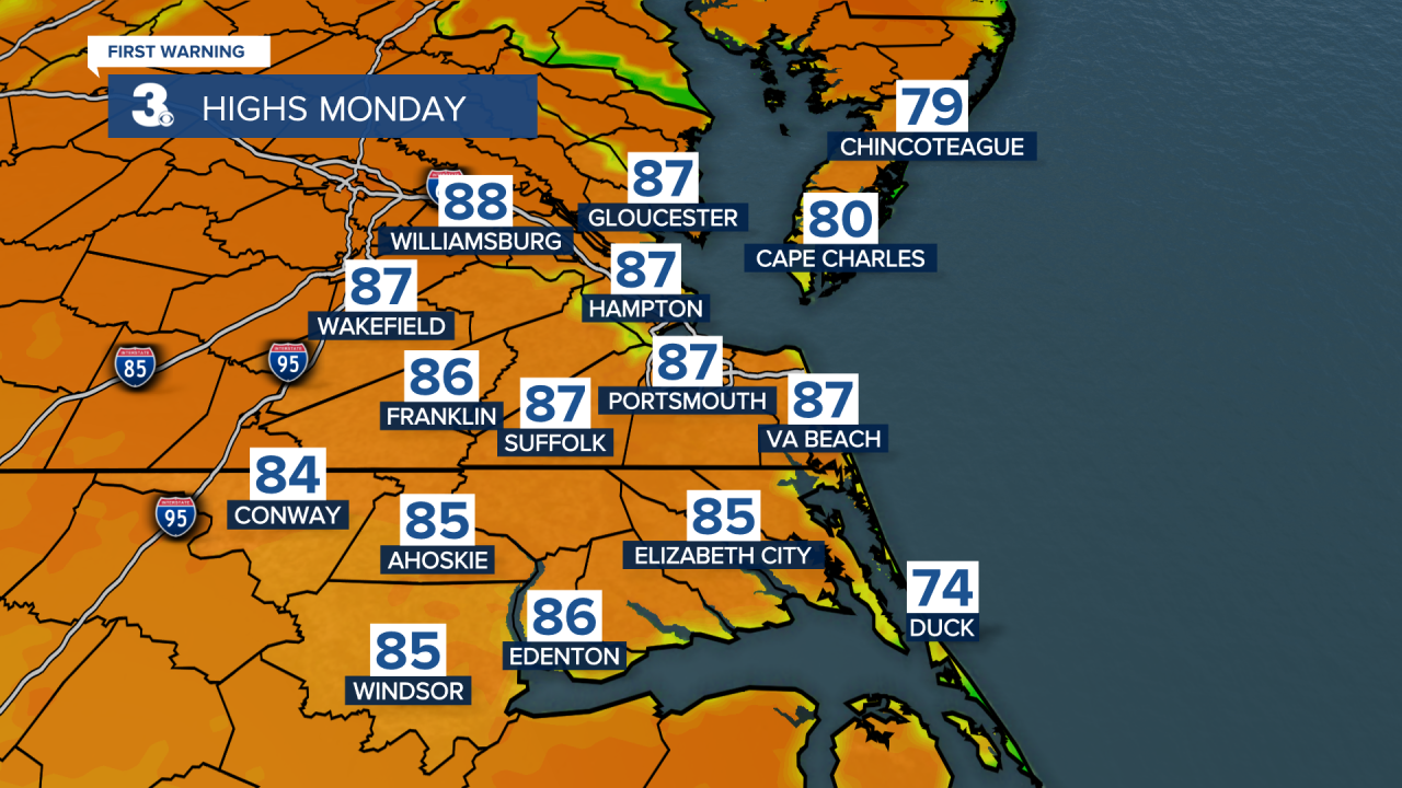
A broad area of high pressure is stationed just to our southeast. the clockwise flow of wind around that front is pushing in some unseasonably warm weather. Some of us could hit the 90-degree mark by Monday afternoon. And that high should keep our skies mainly clear.

Tuesday will be another warm day. But we'll start to see the first hints at some changes on the way. Most clouds will developing in the afternoon and evening as a cold front approaches from the west.

That front will bring a few showers and thunderstorms by Wednesday afternoon, followed by sharply cooler temperatures. Many of us may not make it out of the 60s behind the front on Thursday.
Another round of showers and storms is possible next weekend. Stay tuned.
