


Meteorologist April Loveland's First Warning Forecast
Most of the area is socked in with fog this morning. The fog will take a bit to lift.

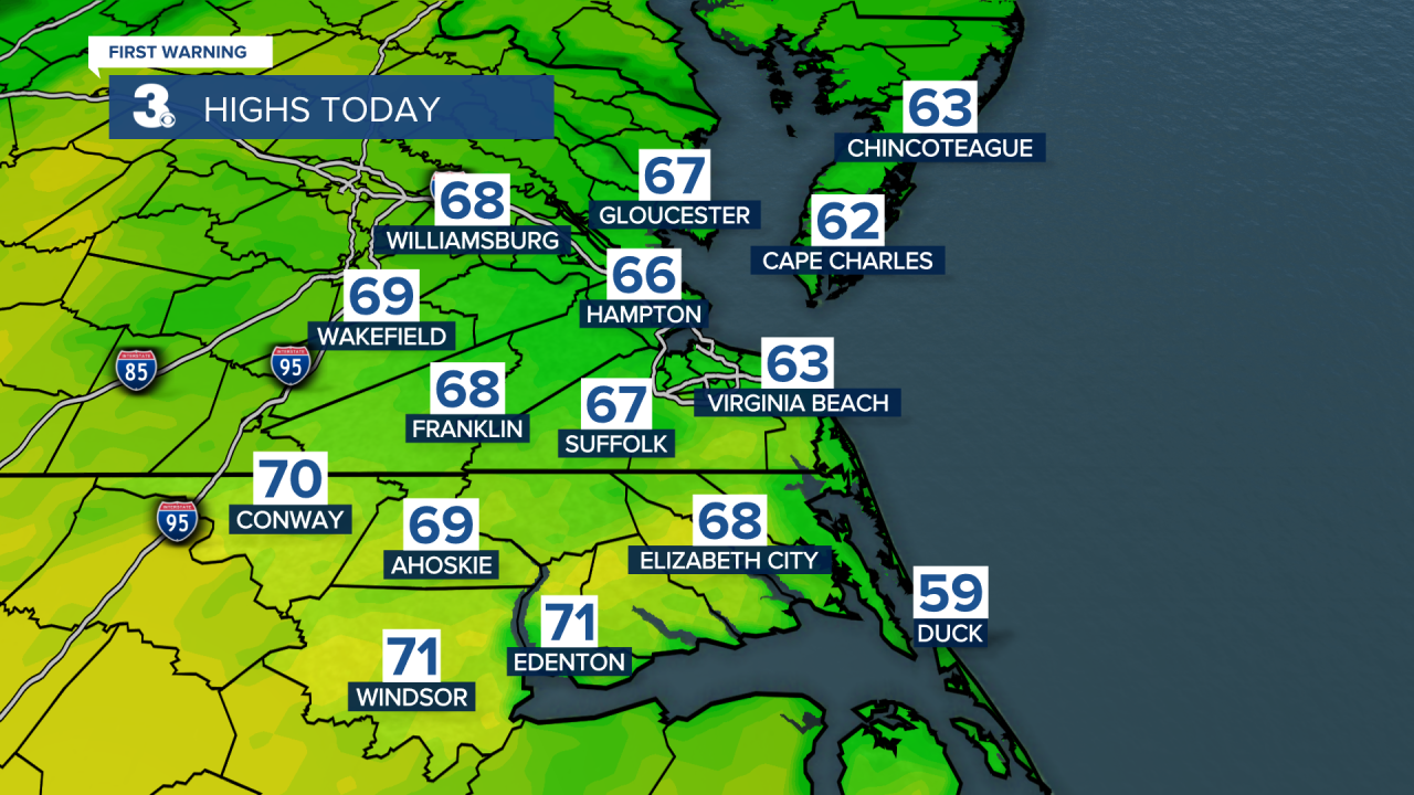
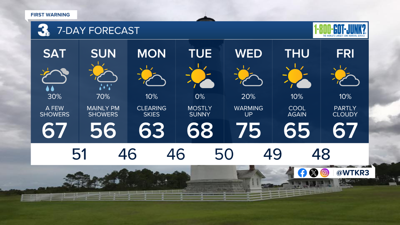
A cold front will cross the area bringing the chance for some widely scattered showers. Temperatures will warm to the 60s. Still staying below normal for this time of year.
Another shot of cooler air will move in tonight. Temperatures will fall into the upper 40s to low 50s overnight.
Better chances for showers on Sunday as an area of low pressure moves across the area. Expect dry conditions to start Sunday with rain moving in from southwest to northeast during the afternoon. It will be a chilly and damp day with highs only warming to the mid 50s. Cool Sunday night with clearing skies and lows in the 40s.

Skies will turn partly cloudy on Monday with highs in the low 60s.
High pressure will be in control on Tuesday. Skies will be mostly sunny with highs warming to the upper 60s.

We'll finally climb to the mid 70s on Wednesday under partly cloudy skies. A cold front will move through, but it's looking mainly dry right now. It will however, drop our temperatures for Thursday. Thursday will fall back into the mid 60s under mostly sunny skies.
Partly cloudy and dry to end the work week with highs in the mid and upper 60s.
Meteorologist April Loveland
For weather updates on Facebook: HERE
Follow me on Twitter: HERE
Follow me on Instagram HERE
Check out the Interactive Radar on WTKR.com: Interactive Radar
