


Meteorologist April Loveland's First Warning Forecast
An area of low pressure will move through today spreading rain across the area. Most of the heaviest rain will happen before noontime. A cold front will move through around lunch time bringing more rain and we'll even have the chance for some storms. Temperatures will warm to the mid 60s ahead of the cold front. Once the cold front moves through this afternoon, winds will turn to the north bringing in some cooler air. Expect winds to increase to 20-30 mph, with higher gusts. The entire day will not be a washout. If you have afternoon or dinnertime plans, you should stay dry.
A Wind Advisory is in effect for coastal locations starting at 7 PM Saturday and running through 7 PM Sunday.

A Coastal Flood Advisory is in effect until 3 PM Saturday for Pasquotank and Camden Counties in North Carolina.

Dry and sunny on Sunday, but it will be windy! Sunday morning wind chills in the 20s are possible. Brr!
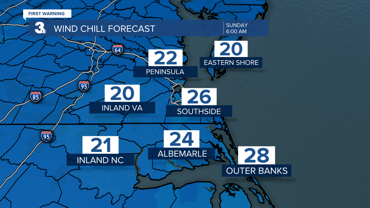
Temperatures will only warm to the low 50s, which is about 10 degrees below normal for this time of year. Expect winds out of the north at 20-30 mph, with gusts up to 45 mph possible.

Even though it won't be raining, flooding will still be an issue. Tidal flooding will be possible starting Sunday morning and continue through at least Tuesday. As of now, high tide as Sewells Point on Monday at 10 PM, looks to be the worst of it. Ocean overwash will also be possible along the Outer Banks. Accoring to NCDOT, NC12 on the north end of Ocracoke is now closed due to ocean overwash and unsafe driving conditions. Ferry service between Hatteras and Ocracoke has been suspended until further notice.

The sun and wind will stick around for Monday. Temperatures will once again top out in the low 50s.
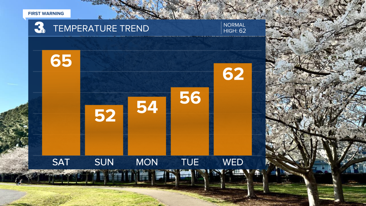
Still breezy, but we'll feel some improvement by Tuesday. Winds will be out of the northeast at 10-15 mph, with a few higher gusts. Highs will be in the mid 50s.
Wednesday will warm into the low 60s, but showers will be possible by the afternoon. The wet weather will continue on Thursday. Expect showers and mostly cloudy skies. Temperatures will cool to the mid 50s.

A few lingering morning showers for Good Friday. It will turn breezy with north winds at 15-25 mph, with higher gusts. Temperatures will warm to the low 60s.
Meteorologist April Loveland
For weather updates on Facebook: HERE
Follow me on Twitter: HERE
Follow me on Instagram HERE
Check out the Interactive Radar on WTKR.com: Interactive Radar
