


Meteorologist April Loveland's First Warning Forecast
Sunny and dry weekend. An unsettled and spring-like stretch next week.
Temperatures will only warm to the upper 40s today. It will be cooler and sunny but not as windy.
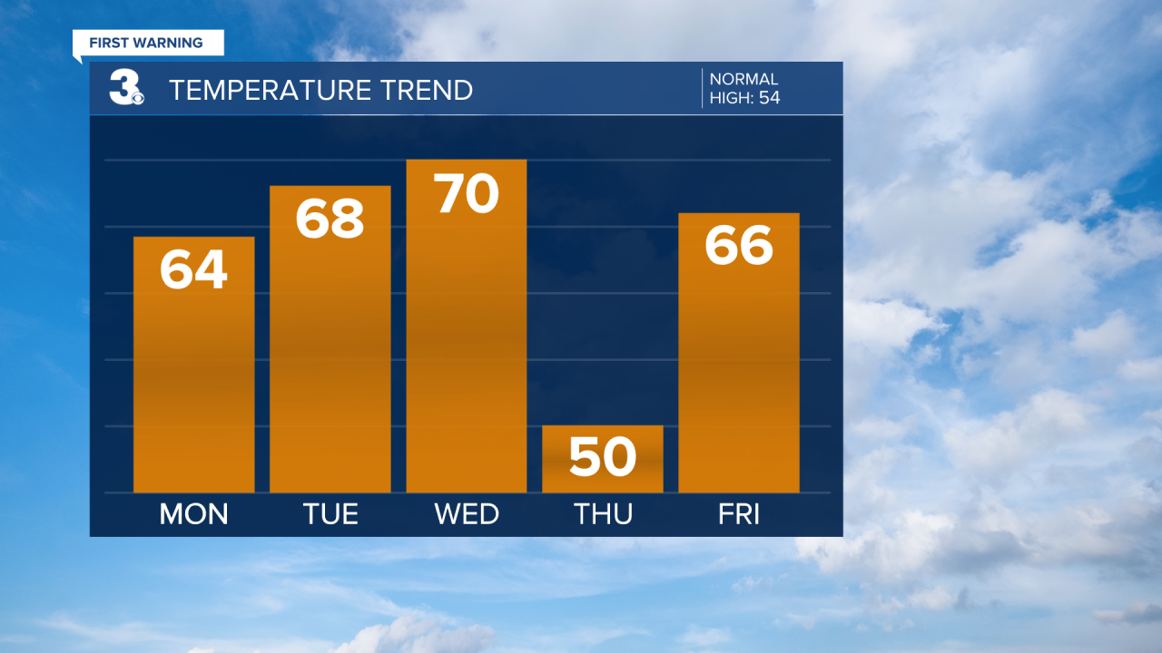
If you have Presidents Day off, it's looking like a gorgeous one! Temperatures will warm to the mid 60s. Clouds will build in as the day progresses.
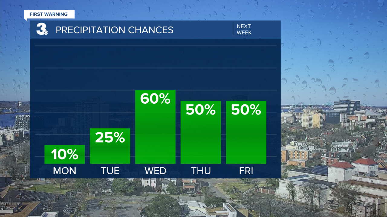
We'll enter an unsettled weather pattern starting Tuesday. Several disturbances will move through the area through the end of the week bringing a chance for showers. Tuesday will be breezy with a few showers possible. Temperatures will warm to the upper 60s. Wednesday is looking to be the wettest and warmest day with highs in the low 70s. Showers will be possible on Thursday, but it will be much cooler with highs in the low 50s. Another warm up on Friday with highs in the upper 60s. Expect to need the umbrella.
Meteorologist April Loveland
For weather updates on Facebook: HERE
Follow me on Twitter: HERE
Follow me on Instagram HERE
Check out the Interactive Radar on WTKR.com: Interactive Radar
