

Chief Meteorologist David Aldrich's First Warning Forecast
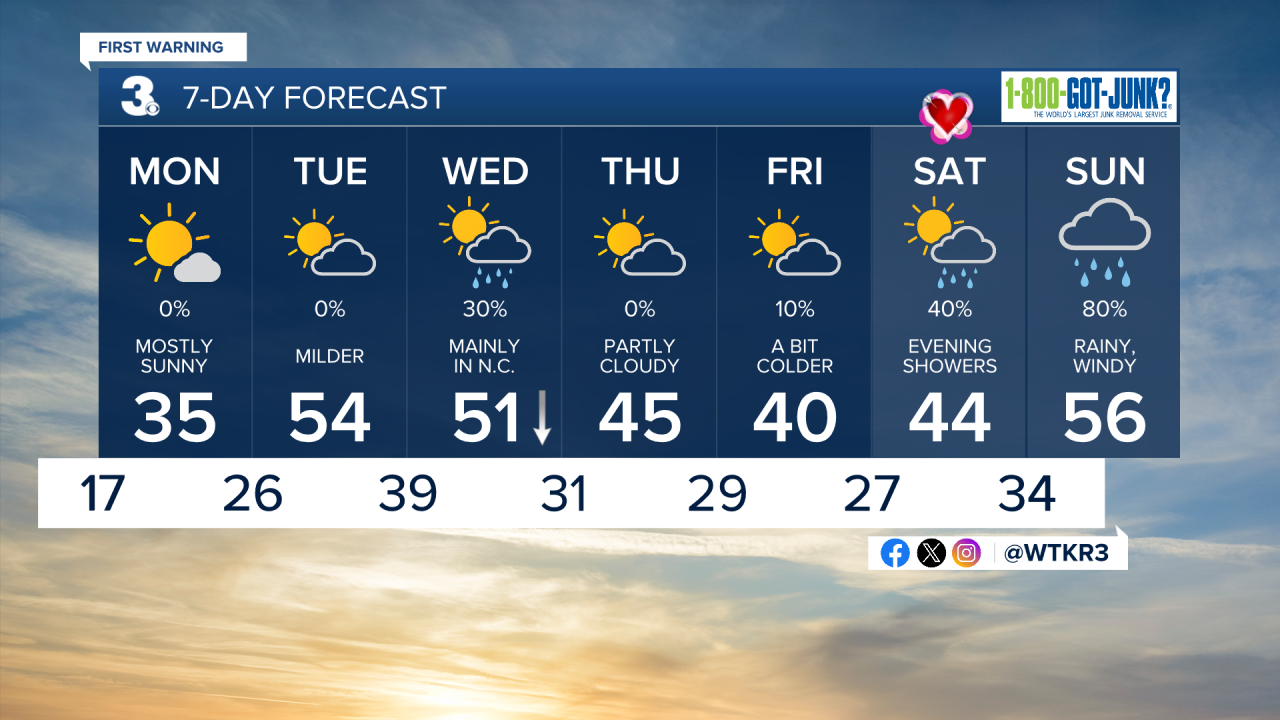
Well, the countdown is on. Sure, it is still cold, but the countdown to warmer weather is on. We are less than two days away from highs reaching into the mid-50s for Hampton Roads and Northeast North Carolina. Doesn't that sound nice? A bona fide "heat wave," I suppose, given what we have experienced here lately. Just be patient, it's coming.
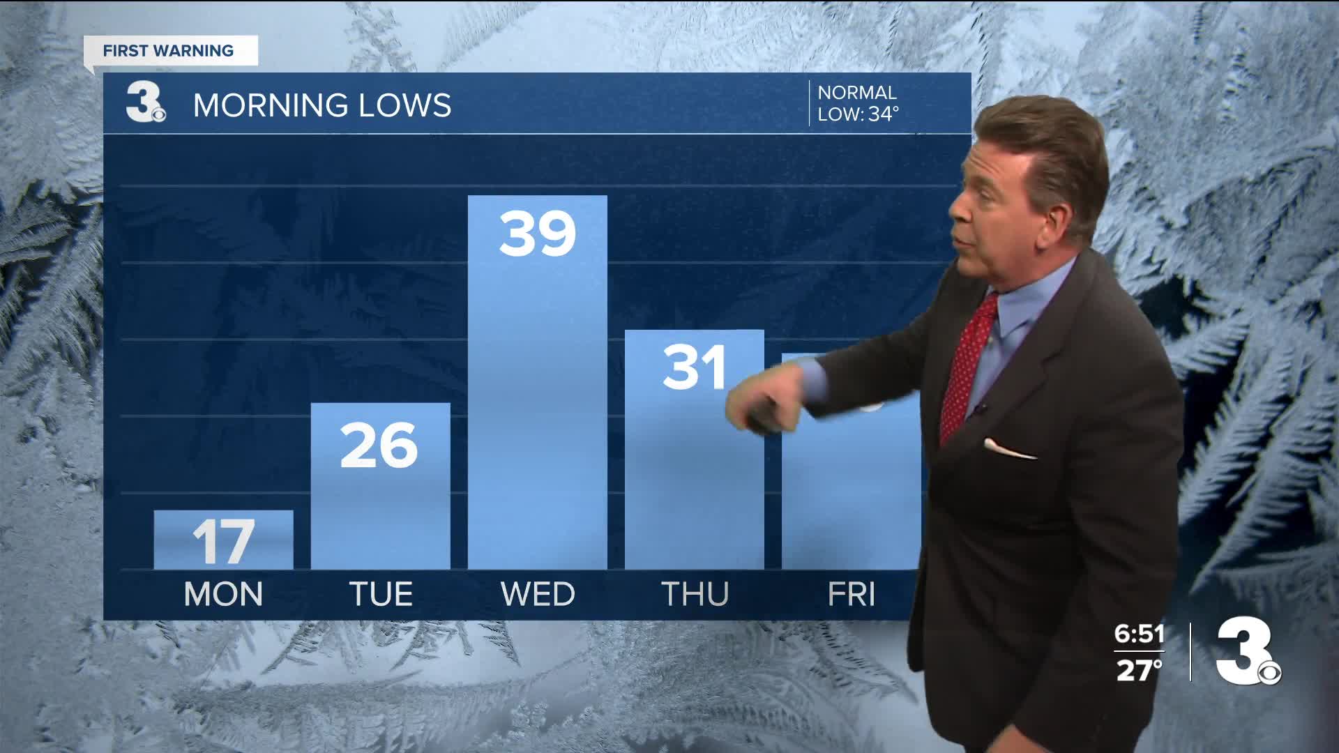
Later tonight and through 10 AM Monday, the National Weather Service has declared another "Cold Weather Advisory" for wind chill values as low as around 5 degrees above.
With bright sunshine and cold air lingering, look for highs on Monday to reach the mid 30s with winds less than 10 mph by midday and nearly calm winds across our neighborhoods by 4 PM Monday.
Monday night, more clouds roll in with lows in the mid 20s.
By Tuesday, expect a partly cloudy start to a mostly sunny finish and highs in the mid-50s.
Looking ahead to the weekend, there will be LOVE in the air on Valentine's Day, which is this Saturday. This Saturday starts dry, but evening showers are anticipated, a 40% chance of rain.
On Sunday, expect gray skies, rainy conditions (roughly 1.00 to 1.50" of rain on average, based on today's data) and windy conditions. The chance of rain on Sunday favors an 80% chance.


Weather updates on social media:
Facebook: AldrichWeather
Instagram: @davidaldrichweather
X (Twitter): @AldrichWeather
