


Chief Meteorologist David Aldrich's First Warning Forecast
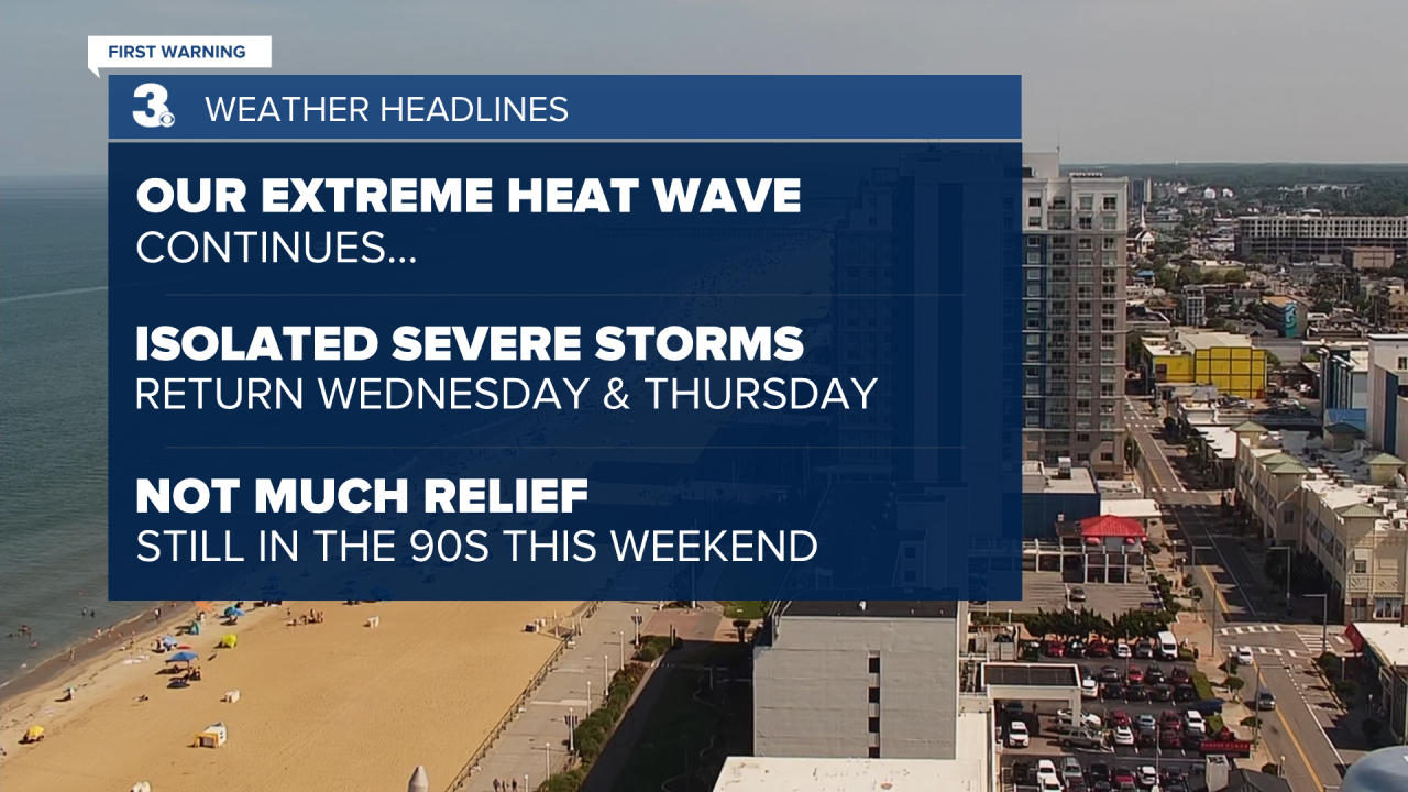
Our extreme heat wave continues with more triple digit "feels like" temperatures on the way. The National Weather Service in Wakefield keeps our Extreme Heat Warning in effect to at least 8 PM Wednesday. For a cooling location, consider visiting your local library, grocery store, shopping mall or even a movie theater.
While the chance of rain is only 30% over the next couple of days, when it rains, it will likely pour, thanks to the high humidity. Strong to isolated or spotty severe storms will be possible as well.
Looking ahead to the weekend, don't expect much in terms of relief, high temperatures will still climb into the 90s.


Weather updates on social media:
Facebook: AldrichWeather
Instagram: @davidaldrichweather
X (Twitter): @AldrichWeather
