

Chief Meteorologist David Aldrich's First Warning Forecast
Happy New Year !
If you have been waiting for warmer air, there is some good news for Day 2 of 2026. It should be turning milder on Friday afternoon, as many of us climb into the 50s across Hampton Roads. Some parts of Northeast North Carolina climbed into the 50s today, but even more locations should experience that warmth later Friday. Expect partly cloudy skies with highs in the lower to mid 50s.
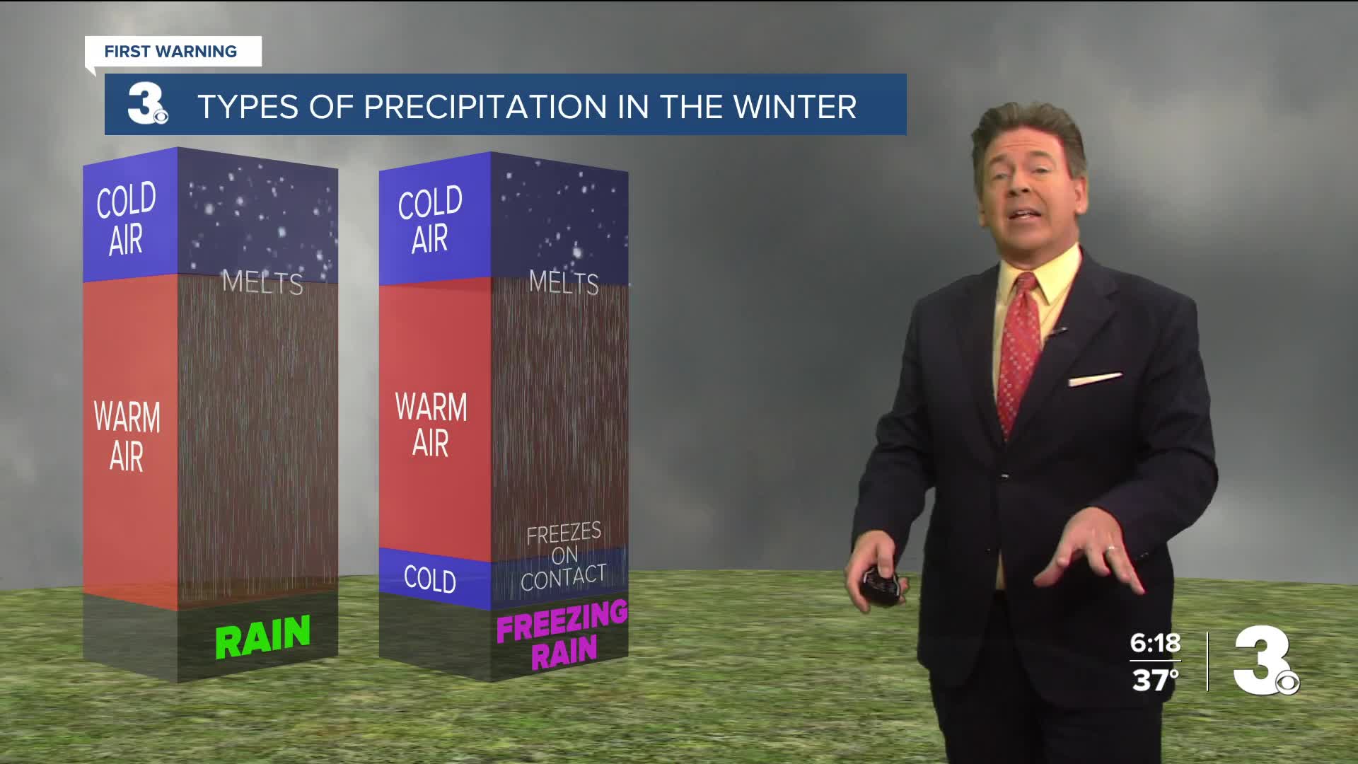
Looking ahead to the weekend, Sunday looks better for outdoor activities, as compared to Saturday. Saturday should be mainly gray with rain showers developing late morning on...and even some snow / mix possible for the Peninsula and Eastern Shore, especially. Highs on Saturday should arrive early in the day....around 45 degrees and falling. Any mix that falls could include sleet or icy pellets, freezing rain or just some melting snowflakes, along with the rain.
This rain and snow / mix should continue into Saturday night as well. Early expectation is for a Trace to 0.50" of snow showers to fall in the Northern Neck, Peninsulas and Eastern Shore, but even less to actually stick.
By Sunday, look for mostly sunny skies to return, but still chilly with highs in the lower to mid 40s.


Weather updates on social media:
Facebook: AldrichWeather
Instagram: @davidaldrichweather
X (Twitter): @AldrichWeather
